Category:Maps of Freie Reichsstadt Mühlhausen
Jump to navigation
Jump to search
Subcategories
This category has only the following subcategory.
T
- Tractus Eichsfeldiae (1759) (13 F)
Media in category "Maps of Freie Reichsstadt Mühlhausen"
The following 11 files are in this category, out of 11 total.
-
 Mühlhausen, Free Imperial City in Thuringia.jpg 2,816 × 2,112; 1.8 MB
-
 Tractus Eichsfeldiae.jpg 5,873 × 4,870; 2.07 MB
-

-

-
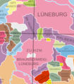 Hannover and Harz 1250.png 688 × 784; 189 KB
-
 J.G.Schreiber Eichsfeld.jpg 2,924 × 2,153; 3.05 MB
-

-
 Map of Thuringia (1680)-NL.svg (Ausschnit Eic).png 498 × 540; 272 KB
-
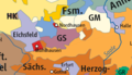 North Thuringia and Harz 1648.png 600 × 346; 85 KB
-
 Spruner-Menke Handatlas 1880 Karte 41 (Eic 1273-1492)).jpg 747 × 738; 306 KB
-
 Spruner-Menke Handatlas 1880 Karte 45 (Eic 1648-1742).jpg 720 × 782; 360 KB


.jpg)
-NL.svg_(Ausschnit_Eic).png)

).jpg)
.jpg)