Category:Maps of Free State municipalities with 2006 borders
Jump to navigation
Jump to search
This category contains maps of municipalities in the Free State province of South Africa that show the the municipal borders as they were after the municipal election of 1 March 2006. The borders of many municipalities changed in 2011.
Media in category "Maps of Free State municipalities with 2006 borders"
The following 65 files are in this category, out of 65 total.
-
 Blank map of the Free State (2006).svg 749 × 667; 1.74 MB
-
 DC16 locator.svg 1,000 × 740; 232 KB
-
 DC17 locator.svg 1,000 × 740; 232 KB
-
 DC18 locator.svg 1,000 × 740; 232 KB
-
 DC19 locator.svg 1,000 × 740; 232 KB
-
 DC20 locator.svg 1,000 × 740; 232 KB
-
 Free State Municipalities.png 1,146 × 828; 24 KB
-
 FS161 locator.svg 1,000 × 740; 232 KB
-
 FS162 locator.svg 1,000 × 740; 232 KB
-
 FS163 locator.svg 1,000 × 740; 232 KB
-
 FS171 locator.svg 1,000 × 740; 232 KB
-
 FS172 locator.svg 1,000 × 740; 232 KB
-
 FS173 locator.svg 1,000 × 740; 232 KB
-
 FS181 locator.svg 1,000 × 740; 232 KB
-
 FS182 locator.svg 1,000 × 740; 232 KB
-
 FS183 locator.svg 1,000 × 740; 232 KB
-
 FS184 locator.svg 1,000 × 740; 232 KB
-
 FS185 locator.svg 1,000 × 740; 232 KB
-
 FS191 locator.svg 1,000 × 740; 232 KB
-
 FS192 locator.svg 1,000 × 740; 232 KB
-
 FS193 locator.svg 1,000 × 740; 232 KB
-
 FS194 locator.svg 1,000 × 740; 232 KB
-
 FS195 locator.svg 1,000 × 740; 232 KB
-
 FS201 locator.svg 1,000 × 740; 232 KB
-
 FS203 locator.svg 1,000 × 740; 232 KB
-
 FS204 locator.svg 1,000 × 740; 232 KB
-
 FS205 locator.svg 1,000 × 740; 232 KB
-
 FSDMA19 locator.svg 1,000 × 740; 232 KB
-
 Map No. 12 of Schedule 2 to Notice 1998 of 2005.png 2,800 × 1,950; 3.97 MB
-
 Map No. 13 of Schedule 2 to Notice 1998 of 2005.png 2,800 × 1,950; 3.73 MB
-
 Map No. 14 of Schedule 2 to Notice 1998 of 2005.png 2,800 × 1,950; 3.95 MB
-
 Map No. 15 of Schedule 2 to Notice 1998 of 2005.png 2,800 × 1,950; 3.95 MB
-
 Map No. 16 of Schedule 2 to Notice 1998 of 2005.png 2,800 × 1,950; 3.89 MB
-
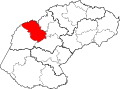
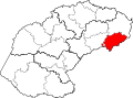
 Map of the Free State with Dihlabeng highlighted (2006).svg 828 × 693; 589 KB
-
 Map of the Free State with Fezile Dabi highlighted (2006).svg 828 × 693; 612 KB
-
 Map of the Free State with Kopanong highlighted (2006).svg 828 × 693; 594 KB
-
 Map of the Free State with Lejweleputswa highlighted (2006).svg 828 × 693; 613 KB
-
 Map of the Free State with Letsemeng highlighted (2006).svg 828 × 693; 592 KB
-
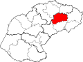
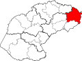
 Map of the Free State with Mafube highlighted (2006).svg 828 × 693; 589 KB
-
 Map of the Free State with Maluti-a-Phofung highlighted (2006).svg 828 × 693; 588 KB
-
 Map of the Free State with Mangaung highlighted (2006).svg 828 × 693; 589 KB
-
 Map of the Free State with Mantsopa highlighted (2006).svg 828 × 693; 587 KB
-
 Map of the Free State with Masilonyana highlighted (2006).svg 828 × 693; 588 KB
-
 Map of the Free State with Matjhabeng highlighted (2006).svg 828 × 693; 585 KB
-
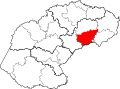
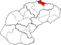
 Map of the Free State with Metsimaholo highlighted (2006).svg 828 × 693; 587 KB
-
 Map of the Free State with Mohokare highlighted (2006).svg 828 × 693; 595 KB
-
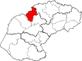
 Map of the Free State with Moqhaka highlighted (2006).svg 828 × 693; 595 KB
-
 Map of the Free State with Motheo highlighted (2006).svg 828 × 693; 599 KB
-
 Map of the Free State with municipalities blank (2006).svg 828 × 693; 1.66 MB
-
 Map of the Free State with Nala highlighted (2006).svg 828 × 693; 589 KB
-
 Map of the Free State with Naledi highlighted (2006).svg 828 × 693; 585 KB
-
 Map of the Free State with Ngwathe highlighted (2006).svg 828 × 693; 587 KB
-
 Map of the Free State with Nketoana highlighted (2006).svg 828 × 693; 587 KB
-
 Map of the Free State with Phumelela highlighted (2006).svg 828 × 693; 596 KB
-
 Map of the Free State with Setsoto highlighted (2006).svg 828 × 693; 591 KB
-
 Map of the Free State with Thabo Mofutsanyana highlighted (2006).svg 828 × 693; 614 KB
-

-
 Map of the Free State with Tokologo highlighted (2006).svg 828 × 693; 589 KB
-
 Map of the Free State with Tswelopele highlighted (2006).svg 828 × 693; 588 KB
-
 Map of the Free State with Xhariep highlighted (2006).svg 828 × 693; 617 KB
-
 South Africa Districts showing Lejweleputswa.png 1,141 × 828; 31 KB
-
 South Africa Districts showing Motheo.png 1,141 × 828; 31 KB
-
 South Africa Districts showing NFS.png 1,141 × 828; 31 KB
-
 South Africa Districts showing Thabo.png 1,141 × 828; 31 KB
-
 South Africa Districts showing Xhariep.png 1,141 × 828; 31 KB


.svg)
.svg)
.svg)
.svg)
.svg)
.svg)
.svg)
.svg)
.svg)
.svg)
.svg)
.svg)
.svg)
.svg)
.svg)
.svg)
.svg)
.svg)
.svg)
.svg)
.svg)
.svg)
.svg)
.svg)
.svg)
.svg)


.svg)
.svg)