Category:Maps of France with rivers
Jump to navigation
Jump to search
Media in category "Maps of France with rivers"
The following 45 files are in this category, out of 45 total.
-
 1800x1730-France-villes.jpg 1,800 × 1,730; 463 KB
-

-
 MapAin.jpg 668 × 600; 449 KB
-
 Châteaux de la Loire - Karte.jpg 4,057 × 1,545; 5.23 MB
-
 MapFranceDordogne.jpg 698 × 717; 538 KB
-
 MapDoubs-2.jpg 602 × 561; 277 KB
-
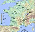
 Fleuves-france.jpg 600 × 612; 46 KB
-
 France & Colonies-1894-canaux & voies navigables de France.jpg 4,512 × 4,792; 2.53 MB
-
 France 5fleuves.svg 2,000 × 1,898; 869 KB
-
 France adm location map.svg 2,000 × 1,922; 524 KB
-
 France blank 1.svg 1,796 × 1,797; 265 KB
-
 France blank 2.svg 1,796 × 1,797; 261 KB
-
 France blank map.gif 328 × 353; 11 KB
-
 France blank.png 1,795 × 1,796; 155 KB
-
 France blank.svg 1,796 × 1,797; 240 KB
-
 France blank3.svg 1,796 × 1,796; 973 KB
-
 France drainage basins mk.svg 2,000 × 1,898; 802 KB
-
 France drainage basins-es.svg 2,133 × 2,025; 893 KB
-
 France drainage basins.svg 2,000 × 1,898; 728 KB
-
 France Fleuve Decize.png 640 × 607; 169 KB
-
 France map Lambert-93 topographic with regions and departements-blank.svg 2,000 × 1,898; 1.67 MB
-
 France map Lambert-93 topographic with regions-blank.svg 2,000 × 1,898; 1.61 MB
-
 France map Lambert-93 topographic-blank.svg 2,000 × 1,898; 1.56 MB
-
 France map Lambert-93 with rivers and regions-blank.svg 2,000 × 1,898; 929 KB
-
 France map Lambert-93 with rivers-blank.svg 2,000 × 1,898; 875 KB
-
 France map with Loire highlighted.jpg 1,797 × 1,796; 845 KB
-
 France university of texas DP.JPG 1,064 × 1,094; 220 KB
-
 France русский.gif 1,050 × 827; 154 KB
-
 France-(road)-EB1911.djvu 4,648 × 3,392; 736 KB
-
 France1911topo.png 1,840 × 1,928; 3.28 MB
-
 France1911towns.png 4,000 × 2,919; 6.56 MB
-
 FranceWater.JPG 868 × 855; 91 KB
-
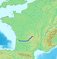
 MapGaronne.jpg 604 × 600; 402 KB
-
 GMT France 20 largest cities.pdf 1,283 × 1,181; 508 KB
-
 GMT France 20 largest cities.png 1,841 × 1,832; 4.3 MB
-
 GMT France with altitudes.pdf 1,181 × 1,181; 145 KB
-
 Loire folyó.jpg 366 × 352; 52 KB
-
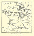
 Parcours simplifié du Lot.jpg 524 × 593; 74 KB
-
 Map Montmorency-Beaufort Champagne France.png 1,614 × 1,510; 3.39 MB
-
 MapDordogne.jpg 668 × 600; 449 KB
-
 MapMoselle.jpg 668 × 600; 449 KB
-
 Reseau-navigable-en-France-fr.png 813 × 877; 61 KB
-
 Rhone river highlighted with Loire.png 600 × 600; 752 KB
-
 MapTarn.jpg 668 × 600; 449 KB
-
 Бассейны пяти великих рек Франции.svg 2,000 × 1,898; 723 KB

.jpg)


