Category:Maps of Fontclaireau
Jump to navigation
Jump to search
Media in category "Maps of Fontclaireau"
The following 7 files are in this category, out of 7 total.
-
 16140-Fontclaireau-argile.jpg 3,057 × 2,480; 539 KB
-
 16140-Fontclaireau-Routes-Hydro.png 3,507 × 2,480; 2.17 MB
-
 16140-Fontclaireau-Routes-Hydro.svg 1,056 × 744; 3.52 MB
-
 16140-Fontclaireau-Sols.png 3,270 × 2,598; 2.18 MB
-
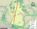
 16140-Fontclaireau-ZNIEFF1.png 5,866 × 4,133; 5.23 MB
-
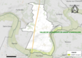 16140-Fontclaireau-ZNIEFF2.png 5,866 × 4,133; 5.29 MB
-
 Map commune FR insee code 16140.png 756 × 605; 37 KB


