Category:Maps of Floreana Island
Jump to navigation
Jump to search
Media in category "Maps of Floreana Island"
The following 6 files are in this category, out of 6 total.
-
 Floreana topographic map-de.png 2,138 × 1,454; 788 KB
-
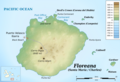 Floreana topographic map-en.png 2,138 × 1,454; 786 KB
-
 Floreana topographic map-es.png 2,138 × 1,454; 793 KB
-
 Floreana3.jpg 585 × 417; 51 KB
-
 Galapagos Islands topographic map-en.svg 2,160 × 2,160; 2.62 MB
-
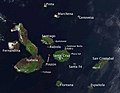 Galapagos-satellite-esislandnames.jpg 674 × 525; 48 KB


