Category:Maps of Fleury-les-Aubrais
Jump to navigation
Jump to search
Wikimedia category | |||||
| Upload media | |||||
| Instance of | |||||
|---|---|---|---|---|---|
| Category combines topics | |||||
| Fleury-les-Aubrais | |||||
French commune in Loiret, Centre-Val de Loire  .svg)  | |||||
| Instance of | |||||
| Location |
| ||||
| Population |
| ||||
| Area |
| ||||
| Elevation above sea level |
| ||||
| official website | |||||
 | |||||
Subcategories
This category has only the following subcategory.
Media in category "Maps of Fleury-les-Aubrais"
The following 14 files are in this category, out of 14 total.
-
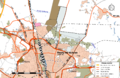 45-Fleury-les-Aubrais-Routes.png 5,457 × 3,543; 4.08 MB
-
 45147-Fleury-les-Aubrais-argile.png 3,057 × 2,480; 3.22 MB
-
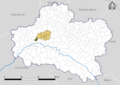
 45147-Fleury-les-Aubrais-Arron.png 7,015 × 4,960; 3.96 MB
-
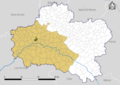
 45147-Fleury-les-Aubrais-Canton.png 7,015 × 4,960; 4.02 MB
-
 45147-Fleury-les-Aubrais-Cours eau.jpg 3,507 × 2,480; 515 KB
-
 45147-Fleury-les-Aubrais-EPCI.png 7,015 × 4,960; 4.01 MB
-
 45147-Fleury-les-Aubrais-Hydro.jpeg 5,846 × 4,133; 3.01 MB
-
 45147-Fleury-les-Aubrais-Orthophoto.jpeg 10,559 × 7,440; 14.82 MB
-
 45147-Fleury-les-Aubrais-Sols.png 3,519 × 2,480; 4.99 MB
-
 Fleury-les-Aubrais-Interco.png 3,507 × 2,480; 1.15 MB
-
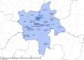
 Map commune FR insee code 45147.png 756 × 605; 70 KB
-
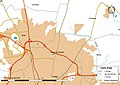
 Orléans-Métropole-déchets-Fleury-les-Aubrais.png 5,457 × 3,589; 1.51 MB
-
 Secteur-college-André-Chene.png 3,519 × 2,480; 2.02 MB
-
 Secteur-college-Condorcet.png 3,519 × 2,480; 1.82 MB


