Category:Maps of Fleurance
Jump to navigation
Jump to search
Wikimedia category | |||||
| Upload media | |||||
| Instance of | |||||
|---|---|---|---|---|---|
| Category combines topics | |||||
| Fleurance | |||||
commune in Gers, France  .svg)  | |||||
| Instance of | |||||
| Location |
| ||||
| Head of government | |||||
| Population |
| ||||
| Area |
| ||||
| Elevation above sea level |
| ||||
| Different from | |||||
| official website | |||||
 | |||||
Media in category "Maps of Fleurance"
The following 11 files are in this category, out of 11 total.
-
 32132-Fleurance-argile.jpg 3,057 × 2,480; 535 KB
-
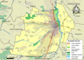
 32132-Fleurance-Natura2000.png 5,846 × 4,133; 10 MB
-
 32132-Fleurance-Natura2000b.png 5,846 × 4,133; 9.97 MB
-
 32132-Fleurance-Routes-Hydro.png 3,507 × 2,480; 2.78 MB
-
 32132-Fleurance-Sols.png 3,507 × 2,480; 2.83 MB
-
 32132-Fleurance-ZNIEFF1.jpg 3,519 × 2,480; 824 KB
-
 32132-Fleurance-ZNIEFF2.png 3,519 × 2,480; 5.64 MB
-
 Fleurance 2018 06 - Plan.jpg 3,589 × 4,785; 3.18 MB
-
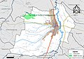
 Fleurance OSM 01.png 726 × 594; 176 KB
-
 Fleurance OSM 02.png 726 × 594; 404 KB
-
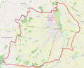
 Map commune FR insee code 32132.png 756 × 605; 43 KB


