Category:Maps of Flagnac
Jump to navigation
Jump to search
Wikimedia category | |||||
| Upload media | |||||
| Instance of | |||||
|---|---|---|---|---|---|
| Category combines topics | |||||
| Flagnac | |||||
commune in Aveyron, France  Мэрия  | |||||
| Instance of | |||||
| Location |
| ||||
| Located in or next to body of water | |||||
| Street address |
| ||||
| Population |
| ||||
| Area |
| ||||
| Elevation above sea level |
| ||||
| official website | |||||
 | |||||
Media in category "Maps of Flagnac"
The following 12 files are in this category, out of 12 total.
-
 12101-Flagnac-Arron.png 3,057 × 2,480; 1.26 MB
-
 12101-Flagnac-cadastre.svg 961 × 744; 5.84 MB
-
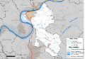
 12101-Flagnac-Canton.png 3,057 × 2,480; 1.25 MB
-
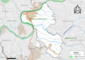
 12101-Flagnac-EPCI.png 3,057 × 2,480; 1.25 MB
-
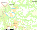
 12101-Flagnac-Hydro.png 3,519 × 2,480; 2.96 MB
-
 12101-Flagnac-Sols.png 3,507 × 2,480; 3.31 MB
-
 12101-Flagnac-ZNIEFF1.png 3,519 × 2,480; 2.29 MB
-
 12101-Flagnac-ZNIEFF2.png 3,519 × 2,480; 2.33 MB
-
 12101-Flagnac-Zone inondable.svg 1,070 × 744; 4.53 MB
-
 Flagnac OSM 01.png 427 × 525; 160 KB
-
 Flagnac OSM 02.png 427 × 525; 312 KB
-
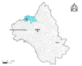
 Map commune FR insee code 12101.png 756 × 605; 76 KB


