Category:Maps of Festes-et-Saint-André
Jump to navigation
Jump to search
Wikimedia category | |||||
| Upload media | |||||
| Instance of | |||||
|---|---|---|---|---|---|
| Category combines topics | |||||
| Festes-et-Saint-André | |||||
commune in Aude, France  .svg)  | |||||
| Instance of | |||||
| Location |
| ||||
| Street address |
| ||||
| Population |
| ||||
| Area |
| ||||
| Elevation above sea level |
| ||||
| official website | |||||
 | |||||
Media in category "Maps of Festes-et-Saint-André"
The following 10 files are in this category, out of 10 total.
-
 11142-Festes-et-Saint-André-argile.jpg 3,057 × 2,480; 414 KB
-
 11142-Festes-et-Saint-André-Natura2000.png 4,677 × 3,307; 6.18 MB
-
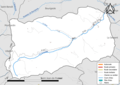 11142-Festes-et-Saint-André-Routes-Hydro.png 3,507 × 2,480; 1 MB
-
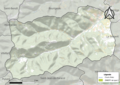
 11142-Festes-et-Saint-André-Sols.png 3,270 × 2,598; 1.26 MB
-
 11142-Festes-et-Saint-André-ZNIEFF1.png 3,057 × 2,480; 4.52 MB
-
 11142-Festes-et-Saint-André-ZNIEFF2.png 3,519 × 2,480; 4.71 MB
-
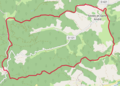 Festes-et-Saint-André OSM 01.png 492 × 352; 110 KB
-
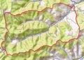 Festes-et-Saint-André OSM 02.png 492 × 352; 388 KB
-
 Festes-et-Saint-André OSM 03.png 492 × 352; 160 KB
-
 Map commune FR insee code 11142.png 756 × 605; 41 KB


