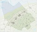
Category:Maps of Ferwerderadiel
Jump to navigation
Jump to search
Wikimedia category | |||||
| Upload media | |||||
| Instance of | |||||
|---|---|---|---|---|---|
| Category combines topics | |||||
| Ferwerderadiel | |||||
former municipality in Friesland, the Netherlands | |||||
| Pronunciation audio | |||||
| Instance of |
| ||||
| Named after | |||||
| Location |
| ||||
| Population |
| ||||
| Area |
| ||||
| Elevation above sea level |
| ||||
| official website | |||||
 | |||||
Subcategories
This category has only the following subcategory.
Media in category "Maps of Ferwerderadiel"
The following 24 files are in this category, out of 24 total.
-
2013-Ferwerderadiel.jpg 2,845 × 2,504; 3.13 MB
-
BAG woonplaatsen - Gemeente Ferweradiel.png 2,419 × 2,419; 513 KB
-
Gem-Ferwerderadiel-2014Q1.jpg 5,539 × 4,684; 8.02 MB
-
Gem-Ferwerderadiel-OpenTopo.jpg 6,833 × 5,911; 4.5 MB
-
Kaarten van Ferwerderadeel - Unknown - 20317371 - RCE.jpg 1,200 × 873; 268 KB
-
Kaarten van Ferwerderadeel - Unknown - 20317372 - RCE.jpg 1,200 × 899; 281 KB
-
LocatieFerwerderadiel.png 280 × 130; 10 KB
-
LocatieFerwert.png 280 × 130; 8 KB
-
LocatieLichtaard.png 280 × 130; 8 KB
-
LocatieWanswert.png 280 × 130; 8 KB
-
Locator map of Bartlehiem.png 280 × 130; 8 KB
-
Map - NL - Ferwerderadiel (2009).svg 625 × 575; 1.53 MB
-
Map NL Ferwerderadiel Blije.png 800 × 500; 34 KB
-
Map NL Ferwerderadiel Burdaard.png 800 × 500; 34 KB
-
Map NL Ferwerderadiel Ferwert.png 800 × 500; 36 KB
-
Map NL Ferwerderadiel Ginnum.png 800 × 500; 34 KB
-
Map NL Ferwerderadiel Hallum.png 800 × 500; 35 KB
-
Map NL Ferwerderadiel Hegebeintum.png 800 × 500; 34 KB
-
Map NL Ferwerderadiel Jannum.png 800 × 500; 34 KB
-
Map NL Ferwerderadiel Jislum.png 800 × 500; 34 KB
-
Map NL Ferwerderadiel Lichtaard.png 800 × 500; 34 KB
-
Map NL Ferwerderadiel Marrum.png 800 × 500; 35 KB
-
Map NL Ferwerderadiel Reitsum.png 800 × 500; 34 KB
-
Map NL Ferwerderadiel Wanswert.png 800 × 500; 34 KB


