Category:Maps of Fertrève
Jump to navigation
Jump to search
Wikimedia category | |||||
| Upload media | |||||
| Instance of | |||||
|---|---|---|---|---|---|
| Category combines topics | |||||
| Fertrève | |||||
commune in Nièvre, France   | |||||
| Instance of | |||||
| Location |
| ||||
| Street address |
| ||||
| Population |
| ||||
| Area |
| ||||
| Elevation above sea level |
| ||||
| official website | |||||
 | |||||
Media in category "Maps of Fertrève"
The following 3 files are in this category, out of 3 total.
-
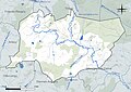 58113-Fertrève-Hydro.jpeg 5,846 × 4,133; 1.68 MB
-
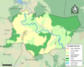 58113-Fertrève-Sols.png 3,270 × 2,598; 1.15 MB
-
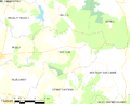 Map commune FR insee code 58113.png 756 × 605; 36 KB

