Category:Maps of False Bay
Jump to navigation
Jump to search
Subcategories
This category has only the following subcategory.
Media in category "Maps of False Bay"
The following 19 files are in this category, out of 19 total.
-
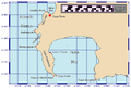
 Coast of Western Cape (South Africa).jpg 488 × 306; 21 KB
-
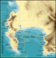
 False Bay Bathymetry from Council for Geoscience.png 640 × 821; 726 KB
-
 False Bay Bathymetry.png 8,288 × 8,106; 4.33 MB
-
 Geological map of the Cape Peninsula and False Bay.png 2,793 × 3,505; 2.18 MB
-
 211 of 'A School Geography' (11157274646).jpg 941 × 852; 170 KB
-
 A chart of False Bay - W. Nichelson - btv1b531773777.jpg 7,250 × 8,736; 6.03 MB
-
 Admiralty Chart No 636 Cape of Good Hope, Published 1828.jpg 6,109 × 8,267; 4.58 MB
-
 Admiralty Chart No 636 The Cape of Good Hope and False Bay, Published 1870, New Edition 1921.jpg 16,175 × 16,599; 27.7 MB
-
 AMH-2534-NA Plan of the Fort of Good Hope.jpg 2,400 × 1,808; 668 KB
-
 CapeHopePeninsulaMap.png 816 × 552; 60 KB
-
 Castle Rocks Map.png 3,008 × 2,854; 1.82 MB
-
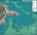
 Dive sites of Cape Town.png 3,068 × 3,202; 2.19 MB
-
 LA2-NSRW Cape of Good Hope.jpg 680 × 793; 316 KB
-
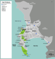
 Map of Elgin and Somerset West.jpg 1,932 × 1,467; 491 KB
-
 Map-South Africa-Western Cape-Cape Peninsula.png 1,204 × 1,302; 275 KB
-
 Sea surface temperatures False Bay.png 640 × 299; 71 KB
-
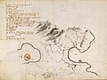
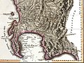 The Dutch Colony of the Cape of Good Hope by William Faden, 1795, crop.jpg 1,409 × 1,059; 881 KB
-
 The Dutch Colony of the Cape of Good Hope by William Faden, 1795.jpg 2,089 × 3,100; 2.84 MB
-
 Topographical map Cape Peninsula and False Bay2.png 2,349 × 2,437; 557 KB
.jpg)


.jpg)


