Category:Maps of Férolles (Loiret)
Jump to navigation
Jump to search
Subcategories
This category has the following 4 subcategories, out of 4 total.
Media in category "Maps of Férolles (Loiret)"
The following 5 files are in this category, out of 5 total.
-
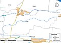
 45-Ferolles-Routes.png 5,457 × 3,543; 2.32 MB
-
 45144-Férolles-Cours eau.jpg 3,507 × 2,480; 403 KB
-
 45144-Férolles-Orthophoto.jpeg 10,559 × 7,440; 8.88 MB
-
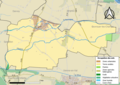 45144-Férolles-Sols.png 3,519 × 2,480; 1.87 MB
-
 Map commune FR insee code 45144.png 756 × 605; 44 KB


