Category:Maps of Espoo
Jump to navigation
Jump to search
Wikimedia category | |||||
| Upload media | |||||
| Instance of | |||||
|---|---|---|---|---|---|
| Category combines topics | |||||
| Espoo | |||||
city in the region of Uusimaa in Finland | |||||
| Instance of | |||||
| Part of | |||||
| Location |
| ||||
| Legislative body |
| ||||
| Official language |
| ||||
| Head of government |
| ||||
| Legal form | |||||
| Inception |
| ||||
| Highest point |
| ||||
| Population |
| ||||
| Area |
| ||||
| Elevation above sea level |
| ||||
| official website | |||||
 | |||||
Subcategories
This category has the following 2 subcategories, out of 2 total.
L
O
- Old maps of Espoo (12 F)
Media in category "Maps of Espoo"
The following 24 files are in this category, out of 24 total.
-
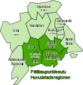
Capital Region Districts of Finland.svg 1,500 × 1,200; 355 KB
-
Espoo sijainti Suomi.svg 1,750 × 2,950; 703 KB
-
Espoo uusimaa.png 1,937 × 962; 74 KB
-
Espoo.sijainti.suomi.2007.svg 1,850 × 3,220; 269 KB
-
Espoo.sijainti.suomi.2008.svg 1,850 × 3,220; 269 KB
-
Espoo.sijainti.Suomi.2020.svg 890 × 1,485; 320 KB
-
Hanaholmen map in June 2024.jpg 4,608 × 3,456; 7.08 MB
-
Helsingin seutu - Helsingforsregionen.svg 517 × 531; 28 KB
-
Helsinki Espoo Vantaa Finland street map.svg 5,408 × 4,328; 18.5 MB
-
Helsinki region roads.jpg 2,775 × 2,374; 1.38 MB
-
Helsinki region roads2.jpg 1,500 × 1,280; 269 KB
-
Jokeri-linja-Jokerlinjen.svg 1,420 × 710; 457 KB
-
Laaksolahti - Kartta.png 3,264 × 2,128; 3.22 MB
-
Lansimetro.svg 400 × 217; 20 KB
-
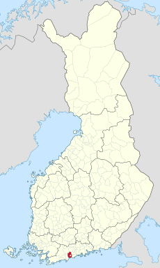
Location of Espoo in Finland.png 230 × 400; 6 KB
-
Länsimetro-Västmetron.svg 1,330 × 500; 310 KB
-
Senate Atlas, 1870–1907. Sheet VI 28 Espoo.jpg 7,200 × 7,063; 8.42 MB
-
Senate Atlas, 1870–1907. Sheet VI 29 Espoo.jpg 7,116 × 7,191; 6.37 MB
-
Senate Atlas, 1870–1907. Sheet VIII 28 Espoo.jpg 7,156 × 7,117; 8.58 MB
-
Subdivisions of Espoo-fi.svg 700 × 1,001; 189 KB
-
Subdivisions of Espoo-sv.svg 700 × 1,001; 189 KB
-
Svenskbygder i Esbo.png 809 × 1,352; 185 KB
-
TramWest kartta.png 781 × 380; 157 KB
-
Tramwest kartta2.png 709 × 372; 39 KB


