Category:Maps of Erfurt (region)
Jump to navigation
Jump to search
Subcategories
This category has only the following subcategory.
M
Media in category "Maps of Erfurt (region)"
The following 6 files are in this category, out of 6 total.
-
 (1867) Übersichtskarte zum Bericht.jpg 2,370 × 2,374; 3.48 MB
-
 KIRCHHOFF(1870) Übersichtskarte von Mittelthüringen.jpg 3,081 × 2,816; 4.12 MB
-
 Thueringsche Staaten 1905.png 2,200 × 1,553; 2.2 MB
-
 Das Eichsfeld um 1900.jpg 1,472 × 1,798; 806 KB
-
 Regierungsbezirk Erfurt 2.png 546 × 417; 609 KB
-
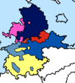 Teilung der preußischen Provinz Sachsen 1944 (cropped).png 214 × 235; 8 KB
_%C3%9Cbersichtskarte_zum_Bericht.jpg)
_%C3%9Cbersichtskarte_von_Mittelth%C3%BCringen.jpg)


.png)