Category:Maps of Epe, Gelderland
Jump to navigation
Jump to search
Subcategories
This category has the following 2 subcategories, out of 2 total.
M
- Maps of Vaassen (7 F)
Media in category "Maps of Epe, Gelderland"
The following 10 files are in this category, out of 10 total.
-
Map - NL - Municipality code 0232 (2009).svg 300 × 160; 531 KB
-
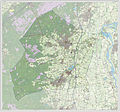
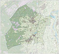
2013-Epe.jpg 3,181 × 2,965; 4.88 MB
-
BAG woonplaatsen - Gemeente Epe.png 2,419 × 2,419; 760 KB
-
Epe, Gemeenteatlas van Nederland.jpg 2,112 × 1,635; 4.47 MB
-
Gem-Epe-2014Q1.jpg 6,197 × 5,676; 14.18 MB
-
Gem-Epe-OpenTopo.jpg 7,491 × 6,950; 8.57 MB
-
Landkarte Epe Gelderland.png 280 × 130; 8 KB
-
LocatieEpe.png 280 × 130; 8 KB
-
Map - NL - Epe (2009).svg 625 × 575; 2.2 MB
-
NL - locator map municipality code GM0232 (2016).png 2,125 × 1,417; 555 KB


