
Category:Maps of Engadin
Subcategories
This category has only the following subcategory.
Media in category "Maps of Engadin"
The following 13 files are in this category, out of 13 total.
-
 1199 Scuol.jpg 14,000 × 9,600; 123.42 MB
-
 1834 Keller Pocket Map of Switzerland - Geographicus - Switzerland-keller-1834.jpg 5,000 × 4,239; 8.18 MB
-
 EuInVallader.jpg 1,476 × 1,397; 144 KB
-
 General map to illustrate Italian Alps (c 1875).jpg 4,240 × 3,125; 5.47 MB
-
 Geologische Karte des Engadiner Fensters.png 1,809 × 1,130; 354 KB
-
 Karte des Ober Engadin - Aus J. M. Ziegler - btv1b84602680.jpg 9,355 × 8,316; 17.26 MB
-

-
 Karte Engadin Grieben mit markierten Paessen.jpg 2,235 × 2,065; 3.88 MB
-
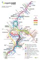 LinienplanEB.pdf 1,752 × 2,479; 922 KB
-

-

-

-
 Ursprung Inn Ygl.jpg 419 × 390; 69 KB


.jpg)


_(14740479686).jpg)
_(14597177398).jpg)
_(14597182058).jpg)
