Category:Maps of Eastern Canada
Jump to navigation
Jump to search
Media in category "Maps of Eastern Canada"
The following 26 files are in this category, out of 26 total.
-
 Central Canadian Shield forests map.svg 1,712 × 1,992; 338 KB
-
 Davis Highlands tundra map.svg 1,712 × 1,992; 338 KB
-
 Eastern Canadian Forests map.svg 1,712 × 1,992; 347 KB
-
 Eastern Canadian Shield taiga map.svg 1,712 × 1,992; 344 KB
-
 Eastern forest-boreal transition map.svg 1,712 × 1,992; 339 KB
-
 High Arctic tundra map.svg 1,712 × 1,992; 364 KB
-
 Eastern Great Lakes Lowland Forests.svg 1,712 × 1,992; 339 KB
-
 Northern tall grasslands map.svg 1,712 × 1,992; 338 KB
-
 AppalachianLocatorMap2.png 637 × 424; 84 KB
-
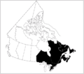
 Eastern Canada Map.JPG 4,000 × 3,124; 663 KB
-
 Eastern Canada map.png 262 × 212; 3 KB
-
 Eastern Canada.png 778 × 685; 41 KB
-
 Eastern Canada.svg 1,084 × 920; 93 KB
-
 Eastern provinces in Canada.svg 512 × 435; 110 KB
-
 Excise Inland revenue map of Eastern Canada, 1884 CTASC.jpg 600 × 275; 222 KB
-
 Fagus grandifolia map.png 756 × 613; 45 KB
-
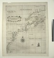
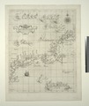
 Nova Anglia Novvm Belgivm et Virginia (NYPL Hades-118542-54667).tif 4,840 × 5,411; 74.93 MB
-
 Carta seconda generale del'America (NYPL Hades-118543-54668).tif 4,667 × 5,010; 66.9 MB
-
 Carta particolare della Nuoua Belgia e parte della Nuoua Anglia (NYPL Hades-118544-54669).tif 4,201 × 4,997; 60.07 MB
-
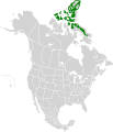
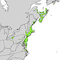
 Liriodendron tulipifera range map 3.png 3,700 × 3,700; 242 KB
-
 Myrica pensylvanica range map.jpg 987 × 975; 333 KB
-
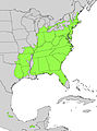 Nyssa sylvatica range map.jpg 1,326 × 1,782; 816 KB
-
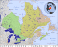 PAT - Eastern Canada.gif 2,200 × 1,760; 1.09 MB
-
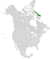
 Taxus canadensis range map.png 1,515 × 1,802; 390 KB
-
 Ilex verticillata range map.jpg 1,353 × 1,672; 848 KB
-
 Tsuga canadensis distribution map.png 650 × 540; 14 KB


