Category:Maps of East Jerusalem
Jump to navigation
Jump to search
Media in category "Maps of East Jerusalem"
The following 21 files are in this category, out of 21 total.
-
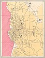 1961 Jordan Tourism Map of Jerusalem.jpg 692 × 890; 151 KB
-
 East Jerusalem.png 897 × 949; 352 KB
-
 East-jerusalem-october-2015-access-restrictions.pdf 1,752 × 2,479; 1.35 MB
-
 EastJerusalemMap-en.svg 384 × 589; 88 KB
-
 EastJerusalemMap-es.svg 384 × 589; 88 KB
-
 EastJerusalemMap.jpg 582 × 593; 85 KB
-
 Greater Jerusalem May 2006 CIA remote-sensing map 3500px.jpg 3,500 × 4,530; 5.54 MB
-
 Greater Jerusalem May 2006 CIA remote-sensing map.jpg 8,264 × 10,696; 53.3 MB
-
 Henry Kendall plan for East Jerusalem 1964.jpg 6,562 × 10,000; 9.96 MB
-
 Isawiya (Al-Issawiya) location map.jpg 634 × 838; 91 KB
-

-
 Jerusalem Wikivoyage city regions maps - Eastern Jerusalem.jpg 392 × 626; 80 KB
-

-
 Karm Al Jaouni, Sheikh Jarrah.jpg 829 × 487; 140 KB
-

-

-
 Palestinians at risk of eviction in East Jerusalem.jpg 1,214 × 829; 220 KB
-

-
 Silwan in the 1865 Ordnance Survey of Jerusalem Old City full map (cropped).jpg 1,973 × 3,231; 3.12 MB
-
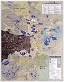
 UN map of Israeli Inner Settlement Ring around Jerusalem.jpg 1,161 × 1,595; 1.38 MB
-
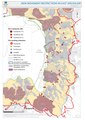
 Zoning in East Jerusalem as of December 2017.jpg 893 × 627; 134 KB


_location_map.jpg)


.jpg)
.jpg)

