Category:Maps of Doubs (river)
Jump to navigation
Jump to search
Subcategories
This category has the following 3 subcategories, out of 3 total.
Media in category "Maps of Doubs (river)"
The following 12 files are in this category, out of 12 total.
-
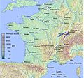
 Bassin du Doubs.png 958 × 655; 689 KB
-
 Besançon 1910 flood map.svg 877 × 986; 1.67 MB
-
 Besançon location map.svg 877 × 986; 2.99 MB
-
 Doubs.png 925 × 556; 1.16 MB
-
 ETH-BIB-La Loue-Le Doubs, Übersichtskarte-Dia 247-Z-00402.tif 3,551 × 2,887; 29.45 MB
-
 France & Colonies-1894-Percée du Doubs.jpg 4,328 × 2,736; 3.55 MB
-
 La Loue (bassin Doubs-Saône) (carte).jpg 628 × 680; 141 KB
-
 Le Doubs (carte).jpg 628 × 680; 142 KB
-
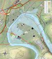
 MapDoubs-2.jpg 602 × 561; 277 KB
-
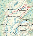
 MapDoubs.jpg 668 × 600; 449 KB
-
 Tracé du Doubs.jpg 918 × 996; 296 KB
-


_(carte).jpg)
.jpg)


