Category:Maps of Donauwörth
Jump to navigation
Jump to search
Media in category "Maps of Donauwörth"
The following 6 files are in this category, out of 6 total.
-
Albrandweg Streckenverlauf Detailkarte.jpg 1,952 × 592; 321 KB
-
Donauwörth in DON.svg 654 × 679; 464 KB
-
Landkreis Donauwoerth.png 581 × 599; 25 KB
-
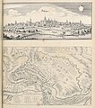
Schwedische Belagerung der Stadt Donauwörth im Jahr 1632.png 1,600 × 1,248; 4.73 MB
-
Stadtbus Donauwoerth.png 2,259 × 1,597; 236 KB


