Category:Maps of Diemen
Jump to navigation
Jump to search
Wikimedia category | |||||
| Upload media | |||||
| Instance of | |||||
|---|---|---|---|---|---|
| Category combines topics | |||||
| Diemen | |||||
town and municipality in the Netherlands | |||||
| Pronunciation audio | |||||
| Instance of | |||||
| Location | North Holland, Netherlands | ||||
| Located in or next to body of water | |||||
| Population |
| ||||
| Area |
| ||||
| official website | |||||
 | |||||
Subcategories
This category has the following 2 subcategories, out of 2 total.
O
- Old maps of Diemen (4 F)
Media in category "Maps of Diemen"
The following 24 files are in this category, out of 24 total.
-
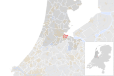
Map - NL - Municipality code 0384 (2009).svg 300 × 160; 530 KB
-
2012-Top10AHNBAG-Gem-Diemen.jpg 1,335 × 1,039; 737 KB
-
2013-Diemen.jpg 1,569 × 1,260; 1.29 MB
-
BAG woonplaatsen - Gemeente Diemen.png 2,419 × 2,419; 618 KB
-
Diemen 1868 map 01.gif 1,614 × 1,411; 295 KB
-
Diemen 1868 map 01.PNG 863 × 753; 319 KB
-
Dutch Municipality Diemen 2006.png 280 × 130; 9 KB
-
Gem-Diemen-2014Q1.jpg 2,822 × 2,336; 3.18 MB
-
Gem-Diemen-OpenTopo.jpg 2,629 × 1,999; 887 KB
-
Gravure hoogheemraadschap Zeeburg en Diemerzeedijk.PNG 867 × 561; 958 KB
-
Gvb tramlijn9.png 1,034 × 920; 1.13 MB
-
Haveneiland-01.png 2,441 × 1,939; 1.89 MB
-
Haveneiland-02.png 2,274 × 2,234; 2.7 MB
-
Hoogheemraadschap Zeeburg en Diemerdijk (3382031016).jpg 1,587 × 2,000; 1.1 MB
-
Hoogheemraadschap Zeeburg en Diemerdijk (op stokken) - J. Wandelaar, 1734-54.jpg 3,707 × 2,592; 4.34 MB
-
IJburg Islands Map October 2020.jpg 2,115 × 2,018; 5.74 MB
-
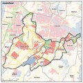
Kaart Amstelland-Meerlanden jan 2019.pdf 1,239 × 1,239; 3.45 MB
-
Knooppunt Diemen.png 800 × 561; 618 KB
-
KnooppuntDiemen.PNG 225 × 261; 15 KB
-
Map - NL - Diemen (2009).svg 625 × 575; 2.49 MB
-
Map - NL - Municipality code 0384 (2014).png 2,000 × 1,067; 237 KB
-
NL - locator map municipality code GM0384 (2016).png 2,125 × 1,417; 473 KB
-
OSM - knooppunt Diemen.PNG 384 × 332; 49 KB
-
OSM - knooppunt Watergraafsmeer.PNG 468 × 364; 84 KB


