Category:Maps of De Marne
Jump to navigation
Jump to search
Subcategories
This category has the following 5 subcategories, out of 5 total.
M
- Maps of Eenrum (4 F)
- Maps of Kloosterburen (2 F)
- Maps of Leens (2 F)
- Maps of Ulrum (2 F)
Media in category "Maps of De Marne"
The following 12 files are in this category, out of 12 total.
-
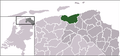 LocatieDeMarne.png 280 × 130; 9 KB
-
 Map - NL - Municipality code 1663 (2009).svg 300 × 160; 530 KB
-
 2013-DeMarne.jpg 4,234 × 2,660; 4.32 MB
-
 BAG woonplaatsen - Gemeente De Marne.png 2,419 × 2,419; 772 KB
-
 Gem-DeMarne-2014Q1.jpg 8,489 × 5,238; 11.39 MB
-
 Gem-DeMarne-OpenTopo.jpg 10,684 × 6,485; 7.22 MB
-
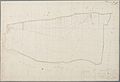
 Kadasterkaart Leens E 1 (Mensingeweer) - R.B. van Leggelo, 1832 (minuutplan) - Matenesse.jpg 11,970 × 8,192; 12.91 MB
-
 Kadasterkaart Ulrum D 1 (Azinga) - A. van Dongen, 1832 (minuutplan) - Asinga.jpg 11,692 × 7,970; 13.13 MB
-
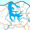 Lauwersmeer.png 833 × 831; 88 KB
-
 Map - NL - De Marne (2009).svg 625 × 575; 1.49 MB
-
 Middag-Humsterland.jpg 483 × 601; 139 KB
-
 Natura2000 - Lauwersmeer.png 2,016 × 2,267; 417 KB

.svg)


_-_R.B._van_Leggelo,_1832_(minuutplan)_-_Matenesse.jpg)
_-_A._van_Dongen,_1832_(minuutplan)_-_Asinga.jpg)

.svg)

