Category:Maps of Dax
Jump to navigation
Jump to search
Subcategories
This category has only the following subcategory.
Media in category "Maps of Dax"
The following 11 files are in this category, out of 11 total.
-
40 LANDES carte grille communale densite INSEE.png 3,507 × 2,480; 2.63 MB
-
40088-Dax-argile.jpg 3,057 × 2,480; 642 KB
-
40088-Dax-Sols.png 3,270 × 2,598; 5.11 MB
-
40088-Dax-ZNIEFF1.png 4,692 × 3,307; 10.1 MB
-
40088-Dax-ZNIEFF2.png 5,866 × 4,133; 13.18 MB
-
Dax (1690499) Limite administrative.jpg 955 × 578; 158 KB
-
Dax (75879) Limite communale.jpg 963 × 575; 183 KB
-
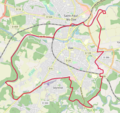
Dax OSM 01.png 536 × 505; 184 KB
-
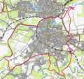
Dax OSM 02.png 536 × 505; 325 KB
-
Grand Dax.png 881 × 851; 301 KB
-
Map commune FR insee code 40088.png 756 × 605; 63 KB


