Category:Maps of Dame-Marie-les-Bois
Jump to navigation
Jump to search
Wikimedia category | |||||
| Upload media | |||||
| Instance of | |||||
|---|---|---|---|---|---|
| Category combines topics | |||||
| Dame-Marie-les-Bois | |||||
commune in Indre-et-Loire, France   | |||||
| Pronunciation audio | |||||
| Instance of | |||||
| Location |
| ||||
| Street address |
| ||||
| Population |
| ||||
| Area |
| ||||
| official website | |||||
 | |||||
Subcategories
This category has only the following subcategory.
Media in category "Maps of Dame-Marie-les-Bois"
The following 11 files are in this category, out of 11 total.
-
 37095-Dame-Marie-les-Bois-argile.png 3,057 × 2,480; 1.84 MB
-
 37095-Dame-Marie-les-Bois-Cours eau.jpg 3,507 × 2,480; 443 KB
-
 37095-Dame-Marie-les-Bois-Hydro.jpeg 5,846 × 4,133; 1.41 MB
-
 37095-Dame-Marie-les-Bois-Sols.png 3,270 × 2,598; 1.26 MB
-
 Dame-Marie-les-Bois (Indre-et-Loire) dans son Arrondissement.png 2,000 × 2,182; 517 KB
-
 Dame-Marie-les-Bois butte.jpg 796 × 494; 96 KB
-
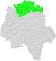 Dame-Marie-les-Bois canton.svg 1,000 × 1,091; 132 KB
-
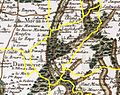 Dame-Marie-les-Bois Cassini.jpg 388 × 306; 52 KB
-
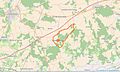 Dame-Marie-les-Bois Limite communale.jpg 956 × 577; 151 KB
-
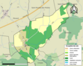
 Dame-Marie-les-Bois urbanisme.svg 522 × 564; 29 KB
-
 Map commune FR insee code 37095.png 756 × 605; 37 KB


_dans_son_Arrondissement.png)


