Category:Maps of Dacian tribes
Jump to navigation
Jump to search
English: This category is focused on organizing maps depicting Dacian tribes and cultures. The timespan of concern to this category starts with pre-Roman times and ends somewhere in Late Antiquity/Early Middle Ages when the references to Dacians cease to exist.
Subcategories
This category has the following 3 subcategories, out of 3 total.
P
- Ptolemy's 8th European Map (41 F)
Media in category "Maps of Dacian tribes"
The following 78 files are in this category, out of 78 total.
-
 Albanians as a migrant Dacian people.png 1,584 × 1,140; 455 KB
-

-
 AtlBalk0.jpg 318 × 327; 156 KB
-
 Balkans 200AD.png 436 × 313; 300 KB
-
 Barbarian invasions from 3rd century.png 1,596 × 920; 791 KB
-
 Battle of Abritus.jpg 816 × 859; 494 KB
-
 Bgiusca Jirecek Line.jpg 614 × 561; 176 KB
-
 Boians.png 1,804 × 858; 1.8 MB
-
 Dacia 125.png 390 × 332; 264 KB
-
 Dacia 82 BC bg.png 312 × 261; 32 KB
-
 Dacia 82 BC heb.png 650 × 544; 349 KB
-
 Dacia 82 BC.png 306 × 246; 53 KB
-
 Dacia 82 vChr.png 780 × 506; 1.02 MB
-
 Dacia around 60-44 BC during Burebista, including campaigns - Czech.png 2,901 × 1,866; 1.5 MB
-
 Dacia around 60-44 BC during Burebista, including campaigns - French.png 2,901 × 1,866; 1.35 MB
-
 Dacia around 60-44 BC during Burebista, including campaigns - Italian.png 2,901 × 1,866; 1.48 MB
-
 Dacia Aureliana - 1849.jpg 1,821 × 885; 936 KB
-
 Dacia lorenz fries.jpg 640 × 406; 80 KB
-
 Dacian-Territory-Map.jpg 1,536 × 1,115; 616 KB
-
 Getae 200bc.jpg 549 × 415; 95 KB
-
 GothicInvasions250-251-en.svg 1,030 × 1,076; 237 KB
-
 GothicInvasions250-251-es.svg 1,030 × 1,076; 403 KB
-
 GothicInvasions250-251-pt.svg 1,030 × 1,076; 237 KB
-
 GothicInvasions250-251-zh.svg 1,288 × 1,345; 93 KB
-
 Grcka kolonizacija 550 st. ere.jpg 1,200 × 902; 191 KB
-
 Greek colonies 550 BC (English) (simple map).svg 1,200 × 902; 873 KB
-
 Greek colonies 550 BC-hu.svg 1,200 × 902; 874 KB
-
 Herodotus world map-be-x-old.svg 788 × 476; 277 KB
-
 Herodotus world map-be.svg 788 × 476; 275 KB
-
 Herodotus world map-eu.svg 788 × 476; 274 KB
-
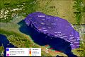
 Illyrian Tribes satellite Map (English).svg 947 × 791; 2.36 MB
-
 Illyrian Tribes satellite Map (Greek).svg 947 × 791; 2.36 MB
-
 Illyrians.jpg 1,054 × 714; 1.27 MB
-
 Kingdom-of-Dacia.jpg 1,200 × 849; 145 KB
-
 Macedonia-Thracia-Illyria-Moesia-Dacia1849.jpg 2,038 × 1,677; 1.12 MB
-
 Macedonia-Thracia-Illyria-Moesia-Dacia1849refurbished.jpg 2,038 × 1,677; 837 KB
-
 Map of Triballi tribe (English).jpg 558 × 396; 123 KB
-
 Marcomannia e Sarmatia 170 dC V1.1 fr.png 1,280 × 886; 1.76 MB
-
 Marcomannia e Sarmatia 170 dC V1.1.JPG 1,280 × 886; 280 KB
-
 Marcomannia e Sarmatia 170 dC.jpg 1,280 × 886; 286 KB
-
 Marcomannia e Sarmatia 171-175 dC.jpg 1,280 × 886; 279 KB
-
 Marcomannia e Sarmatia 178-179 dC.jpg 1,280 × 886; 282 KB
-
 Marcomannia e Sarmatia 180-182 dC.jpg 1,280 × 886; 908 KB
-
 North Western Dacia around 100 AD.png 1,059 × 656; 241 KB
-
 Origins 200 AD.png 769 × 665; 297 KB
-
 Origins 300BC.png 498 × 407; 321 KB
-
 Pannonia popolazioni es.svg 585 × 553; 665 KB
-
 Pannonia popolazioni hr.svg 585 × 553; 341 KB
-
 Pannonia popolazioni png.png 1,435 × 1,356; 127 KB
-
 Roman Dacia de.svg 1,500 × 1,300; 844 KB
-
 Roman Empire 125 (cropped).png 487 × 308; 171 KB
-
 Roman Empire 125 general map-zh.png 2,732 × 2,271; 6.07 MB
-
 Roman Empire 125 general map-zh.svg 2,732 × 2,271; 6.55 MB
-
 Roman Empire 125 general map.SVG 2,186 × 1,817; 1.77 MB
-
 Roman Empire 125 political map-de.svg 2,186 × 1,817; 6.32 MB
-
 Roman Empire 125 political map-zh.png 2,049 × 1,703; 2.99 MB
-
 Roman Empire 125 political map-zh.svg 2,732 × 2,271; 2.02 MB
-
 Roman Empire 125 political map.png 2,186 × 1,817; 3.21 MB
-
 Roman Empire 125 political map.svg 2,186 × 1,817; 3.25 MB
-
 Roman Empire 125.png 2,186 × 1,817; 4.43 MB
-
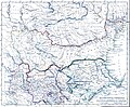
 Roman Empire Map AlexanderFindlay1849.png 2,038 × 1,828; 2 MB
-
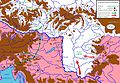
 Roman province of Dacia (106 - 271 AD)-ca.svg 1,500 × 1,300; 395 KB
-
 Roman province of Dacia (106 - 271 AD)-es.svg 1,500 × 1,300; 802 KB
-
 Roman province of Dacia (106 - 271 AD)-pt.svg 512 × 444; 142 KB
-
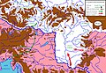
 Roman province of Dacia (106 - 271 AD).svg 1,500 × 1,300; 392 KB
-
 Roman provinces of Illyricum, Macedonia, Dacia, Moesia, Pannonia and Thracia.jpg 2,817 × 2,284; 1.41 MB
-
 Scythia-Parthia 100 BC-ar.png 550 × 350; 280 KB
-
 Scythia-Parthia 100 BC-es.svg 865 × 522; 2.16 MB
-
 Scythia-Parthia 100 BC-pt.svg 865 × 522; 2.11 MB
-
 Scythia-Parthia 100 BC.png 550 × 350; 303 KB
-
 Staemme im antiken Thrakien.svg 1,067 × 717; 19.71 MB
-
 Theoretical map of Romanian origins.png 972 × 751; 705 KB
-

-
 ThracianTribes.jpg 391 × 404; 90 KB
-
 Tribes in Ancient Thrace (English).png 3,000 × 3,000; 7.85 MB
-
 Tribes in Ancient Thrace (English).svg 3,000 × 3,000; 8.66 MB
-
 Tribes in Ancient Thrace (Portuguese).svg 3,000 × 3,000; 8.66 MB
-
 TribesinThrace.jpg 1,800 × 1,221; 597 KB


_(simple_map).svg)


.svg)
.svg)


.jpg)


.png)


-ca.svg)
-es.svg)
-pt.svg)
.svg)


.png)
.svg)
.svg)
