Category:Maps of D-Day
Jump to navigation
Jump to search
Subcategories
This category has the following 2 subcategories, out of 2 total.
M
- Maps of Utah Beach (13 F)
O
- Maps of Omaha Beach (25 F)
Media in category "Maps of D-Day"
The following 40 files are in this category, out of 40 total.
-
 101st Airborne drop pattern, D-Day, 6 June 1944.JPG 1,150 × 1,218; 252 KB
-
 82nd Airborne drop pattern, D-Day, 6 June 1944.JPG 1,900 × 2,100; 887 KB
-
 Aretusa - april.svg 1,123 × 794; 215 KB
-
 Assault Map - Point du Hoe - DPLA - e4d5f7dc8076c622b772d12b1cbe312c (page 1).jpg 6,961 × 6,256; 1.77 MB
-
 Assault Map - Point du Hoe - DPLA - e4d5f7dc8076c622b772d12b1cbe312c (page 2).jpg 6,981 × 6,260; 4.19 MB
-
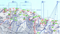
 British D-Day assault area.jpg 3,468 × 1,917; 1.73 MB
-
 Carte 716.png 1,393 × 798; 2.27 MB
-
 D-day allied assault routes map.jpg 1,565 × 1,089; 408 KB
-
 D-day allied assault routes.jpg 1,565 × 1,089; 396 KB
-
 D-Day map, Southwick House.jpg 4,080 × 3,060; 1.62 MB
-
 D-Day map, Southwick House.png 4,080 × 3,060; 14.95 MB
-
 D-Day.jpg 4,000 × 3,619; 9.62 MB
-
 D-Day5-detail.jpg 2,156 × 1,512; 1.86 MB
-
 D-Day5.jpg 4,000 × 3,619; 10.09 MB
-
 Ddayweather.jpg 640 × 424; 116 KB
-
 First Infantry Division Medics in Action- D-Day, 6 June 1944 (8453349).jpg 1,650 × 1,597; 678 KB
-
 Hms arethusa map (rus).svg 461 × 780; 128 KB
-
 Hms arethusa map.png 1,498 × 1,013; 2.27 MB
-
 La Seconde Armée britannique, le Jour « J ».jpg 1,142 × 722; 487 KB
-
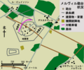
 Merville-Karte.png 587 × 484; 18 KB
-
 Merville-map-ja.png 587 × 484; 53 KB
-
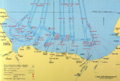
 Naval Bombardments on D-Day (rus).svg 2,055 × 1,329; 268 KB
-
 Naval Bombardments on D-Day.png 1,498 × 1,013; 3.27 MB
-
 Planned airborne drop zones, D-Day, 6 June 1944.JPG 1,300 × 1,208; 363 KB
-
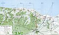
 Pointeduhoc1.jpg 1,000 × 1,346; 286 KB
-
 Situation D+1 - DPLA - 453cedeb8ee616c4c061273b6f8dd27b.JPG 6,752 × 6,019; 3.15 MB
-
 Situation D+13 - DPLA - f57b65c5cb5535722de4c536a4ac8ced.JPG 6,528 × 6,016; 3.12 MB
-
 Situation D+3 - DPLA - 57b9891e9cf1859fcef8a57179514de1.JPG 6,752 × 6,022; 3.2 MB
-
 Situation doublets.jpg 3,508 × 2,480; 1.51 MB
-
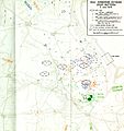
 Situation Map at 1200 HRS - DPLA - 26a486b7574b252d5f284e63610873ee.JPG 13,504 × 12,084; 6.15 MB
-

-
 Situation Map for 1200 Hrs 16 August 1944 - DPLA - a9de2be065afb670b30502e91f1e5614.JPG 6,784 × 6,029; 4.9 MB
-
 Situation Map for 2400 Hrs 12 June 1944 - DPLA - bcd916b560ec0767750a7678eade719a.JPG 6,784 × 6,025; 3.19 MB
-
 Situation Map for 2400 Hrs 13 June 1944 - DPLA - c021cbc256d8f195d11108b98bdbbcda.JPG 6,784 × 6,043; 3.76 MB
-
 Situation Map for 2400 Hrs 15 June 1944 - DPLA - 1aa5306ea8a9b62d535126002e0d4545.JPG 6,784 × 6,028; 3.67 MB
-
 Situation Map, 1st Army - DPLA - f0b9c65e755cbf606c1f9861508ea740.JPG 12,800 × 14,280; 10.57 MB
-
 Southwick house - D day departures 1944-6-6.jpg 1,814 × 1,040; 91 KB
-
 Southwick house D day map room 2019-9-11.jpg 1,795 × 1,129; 81 KB
-
 Southwick house D-day beaches map.jpg 1,701 × 1,123; 93 KB
-
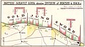
 The Second British Army on D-Day.jpg 2,000 × 1,186; 849 KB


.jpg)
.jpg)


.jpg)
.svg)


.svg)


