Category:Maps of Crosne (Essonne)
Jump to navigation
Jump to search
Wikimedia category | |||||
| Upload media | |||||
| Instance of | |||||
|---|---|---|---|---|---|
| Category combines topics | |||||
| Crosne | |||||
commune in Essonne, France   _-_2022-05-11_-_1.jpg)  | |||||
| Instance of | |||||
| Location | |||||
| Head of government |
| ||||
| Population |
| ||||
| Area |
| ||||
| Different from | |||||
| official website | |||||
 | |||||
Media in category "Maps of Crosne (Essonne)"
The following 18 files are in this category, out of 18 total.
-
 91 Communes Essonne Crosne.png 723 × 750; 166 KB
-
 91191-Crosne - Localisation.png 2,500 × 2,480; 1,017 KB
-
 91191-Crosne-cadastre.png 7,015 × 4,960; 11.17 MB
-
 91191-Crosne-géologie.png 7,015 × 4,960; 11.93 MB
-
 91191-Crosne-Hydro.jpeg 5,846 × 4,133; 2.94 MB
-
 91191-Crosne-Hydro.png 7,015 × 4,960; 10.74 MB
-
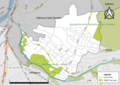
 91191-Crosne-Natura 2000.png 7,015 × 4,960; 4.92 MB
-
 91191-Crosne-Orthophoto.png 7,015 × 4,960; 2.63 MB
-
 91191-Crosne-sols.png 7,015 × 4,960; 11.39 MB
-
 91191-Crosne-Sols.png 3,270 × 2,598; 4.39 MB
-
 91191-Crosne-ZNIEFF1.png 7,015 × 4,960; 4.96 MB
-
 91191-Crosne-ZNIEFF2.png 7,015 × 4,960; 5.42 MB
-
 Chefs-lieux cohortes (vectorized).svg 1,288 × 1,394; 2.23 MB
-
 Crosne - Plan 1900.svg 989 × 845; 1.02 MB
-
 Crosne - Plan seigneurial 1766.png 3,045 × 2,080; 760 KB
-
 Crosne - Table de Peutinger.png 494 × 200; 181 KB
-
 Crosne-VSG Modification territoriale (6-10-1967).svg 479 × 406; 2.12 MB
-
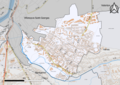
 Map commune FR insee code 91191.png 756 × 605; 43 KB


.svg)


.svg)
