Category:Maps of Cottbus
Jump to navigation
Jump to search
Districts of Brandenburg:
Urban districts (cities):
Wikimedia category | |||||
| Upload media | |||||
| Instance of | |||||
|---|---|---|---|---|---|
| Category combines topics | |||||
| Cottbus | |||||
city in Brandenburg, Germany | |||||
| Instance of |
| ||||
| Part of |
| ||||
| Location |
| ||||
| Located in or next to body of water | |||||
| Street address |
| ||||
| Visitor center |
| ||||
| Head of government |
| ||||
| Population |
| ||||
| Area |
| ||||
| Elevation above sea level |
| ||||
| official website | |||||
 | |||||
Subcategories
This category has the following 3 subcategories, out of 3 total.
L
O
P
Media in category "Maps of Cottbus"
The following 63 files are in this category, out of 63 total.
-
Bahnhofstrasse-Cottbus.png 6,136 × 1,272; 1.87 MB
-
Besitzungen der Herrschaft Cottbus.png 1,938 × 1,472; 259 KB
-
Bhsc.jpg 12,793 × 2,255; 3.48 MB
-
Brandenburg Kr Calau.png 287 × 328; 60 KB
-
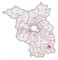
Brandenburg Wahlkreis43.svg 550 × 570; 107 KB
-
Brandenburg Wahlkreis44.svg 550 × 570; 107 KB
-
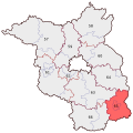
BWahlkreis 65.svg 530 × 530; 45 KB
-
CB in Brandenburg.svg 825 × 826; 78 KB
-
Kreis Cottbus Stadt im Bezirk Cottbus.PNG 1,500 × 2,036; 150 KB
-
Cottbus Branitz.svg 800 × 980; 31 KB
-
Cottbus Dissenchen.svg 800 × 980; 31 KB
-
Cottbus Döbbrick.svg 800 × 980; 31 KB
-
Cottbus Gallinchen.svg 800 × 980; 31 KB
-
Cottbus Groß Gaglow.svg 800 × 980; 31 KB
-
Cottbus in German Democratic Republic.svg 618 × 789; 3 MB
-
Cottbus Kahren.svg 800 × 980; 31 KB
-
Cottbus Kiekebusch.svg 800 × 980; 31 KB
-
Cottbus Madlow.svg 800 × 980; 31 KB
-
Cottbus Merzdorf.svg 800 × 980; 31 KB
-
Cottbus Mitte.svg 800 × 980; 31 KB
-
Cottbus OSM 02.png 669 × 813; 833 KB
-
Cottbus Sachsendorf.svg 800 × 980; 31 KB
-
Cottbus Sandow.svg 800 × 980; 31 KB
-
Cottbus Saspow.svg 800 × 980; 31 KB
-
Cottbus Schmellwitz.svg 800 × 980; 31 KB
-
Cottbus Sielow.svg 800 × 980; 31 KB
-
Cottbus Skadow.svg 800 × 980; 31 KB
-
Cottbus Spremberger Vorstadt.svg 800 × 980; 31 KB
-
Cottbus Ströbitz.svg 800 × 980; 31 KB
-
Cottbus umgeben von SPN.png 299 × 299; 5 KB
-
Cottbus Willmersdorf.svg 800 × 980; 31 KB
-
Cottbus-Position.png 188 × 235; 3 KB
-
Cottbus. Kotwitz genannt.Pilgerkarte um 1500.jpg 347 × 268; 83 KB
-
Die Stadtteile der Stadt Cottbus.png 250 × 281; 21 KB
-
Districts of Cottbus.svg 800 × 980; 31 KB
-
Karte 1.png 1,200 × 1,746; 3.41 MB
-
Karte 2.png 1,201 × 1,766; 4.52 MB
-
Karte 3.png 2,401 × 3,316; 13.76 MB
-
Karte 4.png 1,201 × 1,570; 3.58 MB
-
Karte 5.png 1,200 × 1,570; 3.55 MB
-
Locator map CB in Brandenburg.svg 1,016 × 1,071; 178 KB
-
Meyer‘s Zeitungsatlas 034 – Provinz Brandenburg.jpg 7,344 × 6,273; 18.42 MB
-
Ortsteile von Cottbus.svg 800 × 980; 44 KB
-
Parkbahn Cottbus.jpg 1,148 × 2,718; 494 KB
-
Rundwanderweg Cottbus-Sachsendorf (the map).png 1,592 × 1,580; 3 MB
-
Stadion der Freundschaft Cottbus.png 994 × 800; 701 KB
-
StadtCB1720 Wendische Kirche.jpg 700 × 549; 107 KB
-
StadtCB1720.jpg 700 × 549; 114 KB
-
StadtCB1867.jpg 700 × 509; 90 KB
-
StadtCB1892.jpg 700 × 497; 133 KB
-
StadtCB1913.jpg 700 × 544; 163 KB
-
StadtCB1920.jpg 700 × 611; 136 KB
-
Stadtkarte 1938 1.1.png 1,200 × 1,746; 3.41 MB
-
Stadtkarte 1938- map-aktuell.1.2.png 1,205 × 1,764; 4.54 MB
-
Stadtkarte 1938- map.png 2,401 × 3,316; 15.05 MB
-
Stadtkarte 1938-aktuell.1.png 2,401 × 3,316; 15.05 MB
-
Stadtkarte 1938.1.3.png 1,192 × 1,584; 3.56 MB
-
Stadtkarte 1938.1.4.png 1,201 × 1,570; 3.58 MB
-
Stadtplan-Cottbus-1934.jpg 2,679 × 2,501; 2.1 MB
-
Stadtteile von Cottbus 2013.png 2,448 × 2,720; 1.53 MB
-
Stadtteile von Cottbus.svg 1,100 × 980; 80 KB
-
Tranitz Messtischblatt 4252 Cottbus O-1921.png 731 × 863; 1.32 MB
-
Tranitz Urmesstischblatt 4252 Cottbus O-1845.png 969 × 1,221; 3.33 MB


