Category:Maps of Coprates quadrangle
Jump to navigation
Jump to search
Media in category "Maps of Coprates quadrangle"
The following 20 files are in this category, out of 20 total.
-
 49955 1665rslcontextmap.jpg 1,905 × 900; 667 KB
-
 Arima twins topography ESA289633.jpg 1,920 × 1,129; 848 KB
-
 Arima twins topography ESA289633.tiff 6,123 × 3,600; 60.55 MB
-
 Candor Chasma in false colour ESA218336.jpg 2,610 × 1,500; 1.35 MB
-
 Candor Chasma in false colour ESA218336.tiff 6,500 × 3,736; 41.8 MB
-
 Coprates Chasma (PIA25717 fig1).png 200 × 338; 159 KB
-
 Coprates Chasma (PIA25811 fig1).png 200 × 338; 158 KB
-
 Coprates Chasma and Coprates Catena in context ESA221573.jpg 2,058 × 1,394; 1.82 MB
-
 Coprates map.JPG 638 × 424; 61 KB
-
 Elevation of Melas Chasma region on Mars ESA214943.jpg 3,000 × 1,479; 969 KB
-
 Juventae Chasma topography ESA300760.tiff 6,544 × 3,600; 51.02 MB
-
 LassellMartianCrater.jpg 676 × 648; 100 KB
-
 Louresvallesmola.jpg 1,920 × 1,080; 767 KB
-
 RitcheyMartianCrater.jpg 696 × 598; 105 KB
-
 Thaumasiamapcraters.jpg 1,920 × 1,080; 697 KB
-
 Topographische Karte der östlichen Ausläufer der Valles Marineris (22818882230).jpeg 1,653 × 1,466; 705 KB
-
 Topography of Nectaris Fossae and Protva Valles ESA24696832.jpeg 11,748 × 3,600; 6.9 MB
-
 USGS-Mars-MC-18-CopratesRegion-mola.png 2,499 × 1,999; 4.78 MB
-
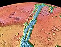 Valles Marineris NASA World Wind map Mars.jpg 1,280 × 982; 240 KB
-
 Valles Marineris PIA00178.jpg 7,170 × 4,991; 3.78 MB


.png)
.png)


.jpeg)


