Category:Maps of Cooch Behar district
Jump to navigation
Jump to search
Districts of West Bengal: Alipurduar · Bankura · Birbhum · Cooch Behar · Dakshin Dinajpur · Darjeeling · Hooghly · Howrah · Jalpaiguri · Jhargram · Kalimpong · Kolkata · Malda · Murshidabad · Nadia · North 24 Parganas · Paschim Bardhaman · Paschim Medinipur · Purba Bardhaman · Purba Medinipur · Purulia · South 24 Parganas · Uttar Dinajpur
Subcategories
This category has the following 2 subcategories, out of 2 total.
Media in category "Maps of Cooch Behar district"
The following 16 files are in this category, out of 16 total.
-
 ADMINISTRATIVE MAP.jpg 16,535 × 11,692; 3.99 MB
-
 Cooch Behar from 1931 Imperial Gazetteer.jpg 780 × 744; 527 KB
-
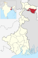 Cooch Behar in West Bengal (India).svg 1,039 × 1,585; 850 KB
-
 Cooch Behar subdivision demarcation.png 927 × 498; 545 KB
-
 Cooch Behar Subdivision Map (bn).svg 512 × 320; 164 KB
-
 Cooch Behar Subdivision Map (en).svg 512 × 320; 113 KB
-
 Cooch Behar Tehsil Map (bn).svg 512 × 320; 122 KB
-
 Cooch Behar Tehsil Map (en).svg 512 × 320; 97 KB
-
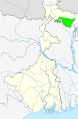 Cooch Bihar West Bengal location map.svg 1,039 × 1,585; 316 KB
-
 Cooch-behar-enclaves-schematisch.png 1,100 × 2,148; 694 KB
-
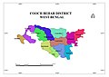
 Coochbehar district.png 287 × 441; 38 KB
-
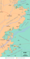
 Dahala Khagrabari Italian.png 2,172 × 1,388; 207 KB
-
 Diagrametic Sketch Map of Cooch behar district showing enclaves.jpg 2,208 × 1,446; 1.07 MB
-
 Land boundary agreement map-hu.svg 778 × 539; 96 KB
-
 Land boundary agreement map.svg 778 × 539; 76 KB
-
 স্থল সীমান্ত চুক্তি মানচিত্র.svg 778 × 539; 342 KB


.svg)

.svg)
.svg)
.svg)
.svg)


