Category:Maps of Communauté d'agglomération Grand Paris Sud Seine-Essonne-Sénart
Jump to navigation
Jump to search
Media in category "Maps of Communauté d'agglomération Grand Paris Sud Seine-Essonne-Sénart"
The following 28 files are in this category, out of 28 total.
-
 Blank map of CA Grand Paris Sud Seine-Essonne-Sénart with num.svg 818 × 614; 40 KB
-

-
 Blank map of CA Grand Paris Sud Seine-Essonne-Sénart.svg 818 × 614; 34 KB
-

-
 Localisation Cesson dans CA Grand Paris Sud Seine-Essonne-Sénart.svg 818 × 614; 34 KB
-

-

-

-

-
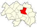
 Localisation Evry dans CA Grand Paris Sud Seine-Essonne-Sénart.svg 818 × 614; 34 KB
-

-
 Localisation Grigny dans CA Grand Paris Sud Seine-Essonne-Sénart.svg 818 × 614; 34 KB
-

-
-
 Localisation Lisses dans CA Grand Paris Sud Seine-Essonne-Sénart.svg 818 × 614; 34 KB
-

-

-
 Localisation Nandy dans CA Grand Paris Sud Seine-Essonne-Sénart.svg 818 × 614; 34 KB
-

-
 Localisation Réau dans CA Grand Paris Sud Seine-Essonne-Sénart.svg 818 × 614; 34 KB
-

-

-

-

-

-
 Localisation Tigery dans CA Grand Paris Sud Seine-Essonne-Sénart.svg 818 × 614; 34 KB
-

-


