Category:Maps of Columbia Plateau
Appearance
Media in category "Maps of Columbia Plateau"
The following 10 files are in this category, out of 10 total.
-
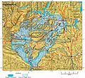
Channeled Scablands during flood.jpg 950 × 879; 179 KB
-
Channeled Scablands on map.jpg 450 × 339; 29 KB
-
Columbia Basin (no cities).svg 1,602 × 1,282; 406 KB
-
Columbia Basin inside Columbia River Drainage Basin.png 2,000 × 2,000; 4.12 MB
-
Columbia Basin.svg 1,602 × 1,282; 421 KB
-
Level IV ecoregions, Columbia Plateau.gif 1,221 × 1,312; 351 KB
-
Level IV ecoregions, Columbia Plateau.png 1,221 × 1,312; 735 KB
-
PacificNW volcanics.png 449 × 637; 25 KB
-
PacificNW volcanics1.png 455 × 700; 28 KB
-
Waterville Plateau.jpg 515 × 697; 128 KB


