Category:Maps of Columbia County, Pennsylvania
Jump to navigation
Jump to search
Counties of Pennsylvania : Adams · Allegheny · Armstrong · Beaver · Bedford · Berks · Blair · Bradford · Bucks · Butler · Cambria · Cameron · Carbon · Centre · Chester · Clarion · Clearfield · Clinton · Columbia · Crawford · Cumberland · Dauphin · Delaware · Elk · Erie · Fayette · Forest · Franklin · Fulton · Greene · Huntingdon · Indiana · Jefferson · Juniata · Lackawanna · Lancaster · Lawrence · Lebanon · Lehigh · Luzerne · Lycoming · McKean · Mercer · Mifflin · Monroe · Montgomery · Montour · Northampton · Northumberland · Perry · Philadelphia · Pike · Potter · Schuylkill · Snyder · Somerset · Sullivan · Susquehanna · Tioga · Union · Venango · Warren · Washington · Wayne · Westmoreland · Wyoming · York
Wikimedia category | |||||
| Upload media | |||||
| Instance of | |||||
|---|---|---|---|---|---|
| Category combines topics | |||||
| Columbia County | |||||
county in Pennsylvania, United States   | |||||
| Instance of | |||||
| Named after | |||||
| Location | Pennsylvania | ||||
| Capital | |||||
| Inception |
| ||||
| Population |
| ||||
| Area |
| ||||
| Different from | |||||
| official website | |||||
 | |||||
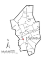
Columbia County is located in north central Pennsylvania in the United States. Its county seat is Bloomsburg.
Subcategories
This category has only the following subcategory.
Media in category "Maps of Columbia County, Pennsylvania"
The following 77 files are in this category, out of 77 total.
-
 Berwick, Pennsylvania. LOC 2007625030.jpg 7,321 × 5,988; 8.4 MB
-
 Blank map of communities in Columbia County, Pennsylvania.png 465 × 556; 80 KB
-
 Bloomsburg-Berwick Micropolitan Area.png 565 × 361; 27 KB
-

-

-
-

-

-
-
-

-

-

-
 Covered bridges in Columbia County, Pennsylvania.png 456 × 532; 84 KB
-
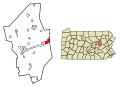
 Map of Almedia, Columbia County, Pennsylvania Highlighted.png 1,280 × 1,700; 46 KB
-
 Map of Aristes, Columbia County, Pennsylvania Highlighted.png 1,280 × 1,700; 46 KB
-
 Map of Beaver Township, Columbia County, Pennsylvania Highlighted.png 1,280 × 1,700; 47 KB
-
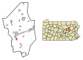
 Map of Benton Township, Columbia County, Pennsylvania Highlighted.png 1,280 × 1,700; 46 KB
-
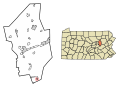
 Map of Benton, Columbia County, Pennsylvania Highlighted.png 1,280 × 1,700; 46 KB
-
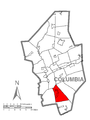
 Map of Berwick, Columbia County, Pennsylvania Highlighted.png 1,280 × 1,700; 46 KB
-
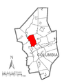
 Map of Bloomsburg, Columbia County, Pennsylvania Highlighted.png 1,280 × 1,700; 46 KB
-
 Map of Briar Creek Township, Columbia County, Pennsylvania Highlighted.png 1,280 × 1,700; 46 KB
-
 Map of Briar Creek, Columbia County, Pennsylvania Highlighted.png 1,280 × 1,700; 46 KB
-
 Map of Buckhorn, Columbia County, Pennsylvania Highlighted.png 1,280 × 1,700; 46 KB
-
 Map of Catawissa Township, Columbia County, Pennsylvania Highlighted.png 1,280 × 1,700; 46 KB
-
 Map of Catawissa, Columbia County, Pennsylvania Highlighted.png 1,280 × 1,700; 46 KB
-
 Map of Centralia, Columbia County, Pennsylvania Highlighted.png 1,280 × 1,700; 46 KB
-
 Map of Cleveland Township, Columbia County, Pennsylvania Highlighted.png 1,280 × 1,700; 46 KB
-
 Map of Columbia County Pennsylvania School Districts.png 294 × 374; 11 KB
-
-
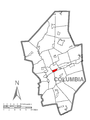
 Map of Columbia County, Pennsylvania No Text.png 1,280 × 1,700; 54 KB
-
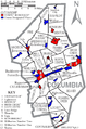
 Map of Columbia County, Pennsylvania.png 1,280 × 1,700; 173 KB
-
 Map of Conyngham Township, Columbia County, Pennsylvania Highlighted.png 1,280 × 1,700; 46 KB
-
 Map of Espy, Columbia County, Pennsylvania Highlighted.png 1,280 × 1,700; 46 KB
-
 Map of Eyers Grove, Columbia County, Pennsylvania Highlighted.png 1,280 × 1,700; 46 KB
-
 Map of Fernville, Columbia County, Pennsylvania Highlighted.png 1,280 × 1,700; 46 KB
-
 Map of Fishing Creek Township, Columbia County, Pennsylvania Highlighted.png 1,280 × 1,700; 46 KB
-
 Map of Franklin Township, Columbia County, Pennsylvania Highlighted.png 1,280 × 1,700; 46 KB
-
 Map of Greenwood Township, Columbia County, Pennsylvania Highlighted.png 1,280 × 1,700; 46 KB
-
 Map of Hemlock Township, Columbia County, Pennsylvania Highlighted.png 1,280 × 1,700; 46 KB
-
 Map of Iola, Columbia County, Pennsylvania Highlighted.png 1,280 × 1,700; 46 KB
-
 Map of Jackson Township, Columbia County, Pennsylvania Highlighted.png 1,280 × 1,700; 46 KB
-
 Map of Jamison City, Columbia County, Pennsylvania Highlighted.png 1,280 × 1,700; 46 KB
-
 Map of Jerseytown, Columbia County, Pennsylvania Highlighted.png 1,280 × 1,700; 46 KB
-
 Map of Jonestown, Columbia County, Pennsylvania Highlighted.png 1,280 × 1,700; 46 KB
-
 Map of Lightstreet, Columbia County, Pennsylvania Highlighted.png 1,280 × 1,700; 46 KB
-
 Map of Lime Ridge, Columbia County, Pennsylvania Highlighted.png 1,280 × 1,700; 46 KB
-
 Map of Locust Township, Columbia County, Pennsylvania Highlighted.png 1,280 × 1,700; 46 KB
-
 Map of Madison Township, Columbia County, Pennsylvania Highlighted.png 1,280 × 1,700; 46 KB
-
 Map of Main Township, Columbia County, Pennsylvania Highlighted.png 1,280 × 1,700; 47 KB
-
 Map of Mainville, Columbia County, Pennsylvania Highlighted.png 1,280 × 1,700; 46 KB
-
 Map of Mifflin Township, Columbia County, Pennsylvania Highlighted.png 1,280 × 1,700; 46 KB
-
 Map of Mifflinville, Columbia County, Pennsylvania Highlighted.png 1,280 × 1,700; 46 KB
-
 Map of Millville, Columbia County, Pennsylvania Highlighted.png 1,280 × 1,700; 46 KB
-
 Map of Montour Township, Columbia County, Pennsylvania Highlighted.png 1,280 × 1,700; 46 KB
-
 Map of Mount Pleasant Township, Columbia County, Pennsylvania Highlighted.png 1,280 × 1,700; 46 KB
-
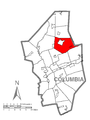
 Map of North Centre Township, Columbia County, Pennsylvania Highlighted.png 1,280 × 1,700; 46 KB
-
 Map of Numidia, Columbia County, Pennsylvania Highlighted.png 1,280 × 1,700; 46 KB
-
 Map of Orange Township, Columbia County, Pennsylvania Highlighted.png 1,280 × 1,700; 46 KB
-
 Map of Orangeville, Columbia County, Pennsylvania Highlighted.png 1,280 × 1,700; 46 KB
-
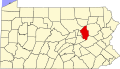 Map of Pennsylvania highlighting Columbia County.svg 1,980 × 1,138; 96 KB
-
 Map of Pine Township, Columbia County, Pennsylvania Highlighted.png 1,280 × 1,700; 46 KB
-
 Map of Roaring Creek Township, Columbia County, Pennsylvania Highlighted.png 1,280 × 1,700; 47 KB
-
 Map of Rohrsburg, Columbia County, Pennsylvania Highlighted.png 1,280 × 1,700; 46 KB
-
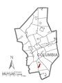
 Map of Rupert, Columbia County, Pennsylvania Highlighted.png 1,280 × 1,700; 46 KB
-
 Map of Scott Township, Columbia County, Pennsylvania Highlighted.png 1,280 × 1,700; 46 KB
-
 Map of Slabtown, Columbia County, Pennsylvania Highlighted.png 1,280 × 1,700; 46 KB
-
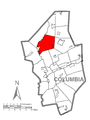
 Map of South Centre Township, Columbia County, Pennsylvania Highlighted.png 1,280 × 1,700; 46 KB
-
 Map of Stillwater, Columbia County, Pennsylvania Highlighted.png 1,280 × 1,700; 46 KB
-
 Map of Sugarloaf Township, Columbia County, Pennsylvania Highlighted.png 1,280 × 1,700; 46 KB
-
 Map of Waller Township, Columbia County, Pennsylvania Highlighted.png 1,280 × 1,700; 46 KB
-
 Map of Wilburton Number One, Columbia County, Pennsylvania Highlighted.png 1,280 × 1,700; 46 KB
-
 Map of Wilburton Number Two, Columbia County, Pennsylvania Highlighted.png 1,280 × 1,700; 46 KB
-
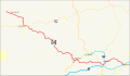 PA-44 map.svg 1,475 × 860; 910 KB
-
 Ricketts Glen State Park Map.png 1,676 × 1,291; 128 KB
-
 USGS map of Fishing Creek Township.png 741 × 598; 1.27 MB
-
 USGS National Map Viewer of Nescopeck Borough and Township, Pennsylvania.png 1,600 × 870; 3.31 MB


