<nowiki>Category:Maps of Churchill County, Nevada; categoría de Wikimedia; kategori Wikimedia; Wikimedia category; د ويکيمېډيا وېشنيزه; Vikimedya kategorisi; ویکیمیڈیا زمرہ; kategória projektov Wikimedia; категорія проєкту Вікімедіа; 维基媒体分类; Wikimedia-Kategorie; Викимедиина категорија; Wikimedia-Kategorie; विकिपीडिया:श्रेणी; page de catégorie de Wikimedia; kategorija na Wikimediji; विकिपीडिया वर्ग; категорија на Викимедији; Wikimedia-Kategorie; Wikimedia-kategori; kategori Wikimédia; تصنيف ويكيميديا; pajenn rummata eus Wikimedia; Wikimedia:ကဏ္ဍခွဲခြင်း; 維基媒體分類; Wikimedia категориясы; categoría de Wikimedia; Wikimedia-Kategorie; Wikimedia-Kategorie; tudalen categori Wikimedia; Viciméid catagóir; Վիքիմեդիայի նախագծի կատեգորիա; 维基媒体分类; Wikimedia-kategory; ვიკიპედია:კატეგორიზაცია; ウィキメディアのカテゴリ; categoria Wikimedia; تصنيف بتاع ويكيميديا; විකිමීඩියා ප්රභේද පිටුව; categoria Vicimediorum; Vikipidiya:Shopni; Wikimedia-luokka; Wikimedia category; guruhi Vikimedia; катэгорыя ў праекце Вікімэдыя; Викимедиа проектындагы төркем; catigurìa di nu pruggettu Wikimedia; หน้าหมวดหมู่วิกิมีเดีย; Wikimedia:Kategorija; Wikimedia-Kategorie; Wikimedia:Klassys; категория на Уикимедия; categorie a unui proiect Wikimedia; 維基媒體分類; Wikimedia-kategori; kawan Wikimèdia; 維基媒體分類; 위키미디어 분류; Wikimedia-bólkur; kategorio en Vikimedio; kategori Wikimedia; Wikimedia:Ronnaghys; উইকিমিডিয়া বিষয়শ্রেণী; kategori Wikimedia; 维基媒体分类; וויקימעדיע קאַטעגאָריע; kategorija w projektach Wikimedije; thể loại Wikimedia; Wikimedia projekta kategorija; kategoria ti Wikimedia; categoria de um projeto da Wikimedia; 维基媒体分类; категорияд Ангилал; Wikimedia-kategori; kategori Wikimedia; پۆلی ویکیمیدیا; Wikimedia category; Vikimédia ñemohenda; Wikimédia-kategória; વિકિપીડિયા શ્રેણી; Wikimediako kategoria; категория в проекте Викимедиа; Wikimedia-Kategorie; Kategoriya ning Wikimedia; Wikimedia-kategorie; Wîkîmediya:Kategorî; विकिमिडिया श्रेणी; Wikimedia-Kategorie; קטגוריה במיזמי ויקימדיה; Викимедиа проектындагы төркем; kategoria w projekcie Wikimedia; विकिमिडिया श्रेणी; κατηγορία εγχειρημάτων Wikimedia; Wikimedia-kategoriija; гурӯҳи Викимедиа; categoria de Wikimedia; Wikimedia-categorie; categoría de Wikimedia; categoria di un progetto Wikimedia; Wikimedia-kategori; Wikimedia-categorie; Wikimedia category; Wikimedia kategooria; categurìa 'e nu pruggette Wikimedia; Викимедиа категорияһы; Wikimedia-categorie; Wikimedia proyektındağı törkem; ẹ̀ka Wikimedia; гурӯҳи Викимедиа; categoria de um projeto da Wikimedia; kategorie na projektech Wikimedia; kategorija na Wikimediji; tumbung Wikimedia; ردهٔ ویکیپدیا; kategorija Wikimedie; kategorya ng Wikimedia; Wikimedia-kategorie; 維基媒體分類; kategori Wikimedia; jamii ya Wikimedia; വിക്കിമീഡിയ വർഗ്ഗം; 維基媒體分類; kategori Wikimedia; катэгорыя ў праекце Вікімедыя; زمرو:وڪيپيڊيا زمرا بندي; kategori e Wikimedias; categoría de Wikimedia; विकिमीडिया श्रेणी; 维基媒体分类; விக்கிமீடியப் பகுப்பு</nowiki>


 Carson Sink 1910.jpg 3,099 × 2,615; 2.42 MB

 Dixie Nevada 1910.jpg 2,384 × 1,530; 1.55 MB
 Fairview & Bermond Station Nevada 1910.jpg 2,622 × 2,323; 1.94 MB
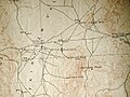 Fairview and Bermond Station Nevada 1910.jpg 4,032 × 3,024; 3.83 MB
 Jessup, Nevada 1910.jpg 2,680 × 1,477; 1.33 MB
 Map of Nevada highlighting Churchill County.svg 5,257 × 7,775; 33 KB
 Nevada Senate District 17 (2012).png 2,503 × 3,600; 357 KB
 Parran Nevada 1910.jpg 2,268 × 2,146; 1.3 MB
 Ragtown, Nevada 1910.jpg 3,924 × 2,943; 2.34 MB
 Stillwater, Nevada 1910.jpg 2,368 × 2,670; 1.91 MB
 White Cloud City Nevada 1910.jpg 1,725 × 3,017; 2.88 MB
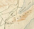 White Plains, Ocala, and Miriam Nevada in 1910.jpg 2,599 × 2,256; 1.86 MB
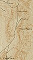 Wonder, Nevada 1910.jpg 1,346 × 2,455; 1.39 MB


.png)


