Category:Maps of Chortkiv Raion (former)
Jump to navigation
Jump to search

Райони: Бережанський · Борщівський · Бучацький · Гусятинський · Заліщицький · Збаразький · Зборівський · Козівський · Кременецький · Лановецький · Монастириський · Підволочиський · Підгаєцький · Теребовлянський · Тернопільський · Чортківський · Шумський ·
Міста: Бережани · Борщів · Бучач · Заліщики · Збараж · Зборів · Копичинці · Кременець · Ланівці · Монастириська · Підгайці · Скалат · Теребовля · Тернопіль · Хоростків · Чортків · Шумськ
Містечка: Велика Березовиця · Великі Бірки · Гримайлів · Гусятин · Дружба · Залізці · Золотий Потік · Козова · Коропець · Мельниця-Подільська · Микулинці · Нагірянка · Підволочиськ · Скала-Подільська ·
Media in category "Maps of Chortkiv Raion (former)"
The following 2 files are in this category, out of 2 total.
-
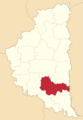
 Chortkiv Raion.svg 1,022 × 682; 5.21 MB
-
 Chortkivskyi-Raion.png 2,000 × 2,902; 354 KB

