Category:Maps of Chinese claim lines in Aksai Chin
Jump to navigation
Jump to search
Media in category "Maps of Chinese claim lines in Aksai Chin"
The following 16 files are in this category, out of 16 total.
-
 1930 Ladakh border of ROC.jpg 238 × 261; 38 KB
-
 1947 ROC claim line in Ladakh.jpg 644 × 619; 172 KB
-
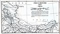 1959 India's Frontier with China by Indian Ministry of External Affairs.jpg 4,392 × 2,514; 1.04 MB
-
 1963-Colombo-proposal-for-Aksai-Chin.jpg 4,904 × 6,782; 7.08 MB
-
 Aksai Chin Sino-Indian border map-ar.svg 650 × 990; 1.21 MB
-
 Aksai Chin Sino-Indian border map.png 624 × 872; 102 KB
-
 Aksai Chin Sino-Indian border map.svg 650 × 990; 364 KB
-
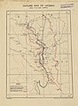 Chinese claim lines and 1962 ceasefire line in Ladakh.jpg 5,024 × 6,804; 5.12 MB
-
 Chinese claim lines in Ladakh - map by CIA.png 931 × 1,100; 162 KB
-
 Depsang Bulge claim lines (1962).jpg 1,323 × 903; 357 KB
-
 Galwan River claim lines (1962).jpg 1,715 × 1,093; 545 KB
-
 Kongka Pass claim lines (1962).jpg 1,449 × 1,219; 558 KB
-
 Kongka-La-snapshot-from-earthworks-stanford-edu-Gogra-Hot-Springs.jpg 1,038 × 646; 63 KB
-
 Pangong Lake claim lines (1962).jpg 1,197 × 1,347; 522 KB
-
 Raki-Jeong-Nalas-LSIB-vs-Chinese-claims.png 897 × 656; 51 KB
-
 South-Pangong-LSIB-vs-Chinese-claims.png 950 × 656; 295 KB


.jpg)
.jpg)
.jpg)

.jpg)

