Category:Maps of Chengdu
Jump to navigation
Jump to search
English: Maps of Chengdu Prefecture and the city of Chengdu — in central Sichuan Province, southwestern China.
中文(简体):成都的地图
Wikimedia category | |||||
| Upload media | |||||
| Instance of | |||||
|---|---|---|---|---|---|
| Category combines topics | |||||
| Chengdu | |||||
capital of Sichuan Province, China | |||||
| Pronunciation audio | |||||
| Instance of |
| ||||
| Part of | |||||
| Location |
| ||||
| Capital | |||||
| Legislative body |
| ||||
| Inception |
| ||||
| Population |
| ||||
| Area |
| ||||
| Elevation above sea level |
| ||||
| Different from | |||||
| Maximum temperature record |
| ||||
| official website | |||||
 | |||||
Subcategories
This category has the following 2 subcategories, out of 2 total.
L
- Locator maps of Chengdu (42 F)
P
Media in category "Maps of Chengdu"
The following 29 files are in this category, out of 29 total.
-
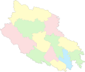
Location of Chengdu City Districts within Sichuan (China).png 880 × 740; 108 KB
-
Location of Chengdu Prefecture within Sichuan (China).png 880 × 740; 108 KB
-
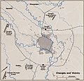
"Chengdu and Vicinity" in 1989 inset detail, from- Chengdu 1989 CIA (cropped).jpg 1,413 × 1,358; 258 KB
-
Chengdu.png 597 × 553; 11 KB
-
Panzhihua.jpg 585 × 505; 34 KB
-
Subdivisions of Chengdu-China.png 499 × 407; 19 KB
-
Administrative Division Chengdu 2.png 2,100 × 1,740; 468 KB
-
Administrative Division Chengdu alt.png 2,100 × 1,720; 468 KB
-
Administrative Division Chengdu.png 2,100 × 1,720; 821 KB
-
Central Asian trade routes V2.jpg 1,280 × 836; 398 KB
-
Chengdu 1989 CIA.jpg 12,359 × 11,004; 13.35 MB
-
Chengdu dot.png 1,804 × 1,322; 278 KB
-
Chengdu location map.jpg 1,351 × 928; 609 KB
-
Chengdu mcp.png 739 × 598; 45 KB
-
Chengdu-map.png 2,000 × 1,637; 1.08 MB
-
Chengdu-map1.png 3,000 × 2,449; 1.71 MB
-
Chengdu.svg 1,052 × 744; 4.73 MB
-
Chengdumap.PNG 602 × 527; 26 KB
-
China srtm 2008133 lrg.jpg 1,200 × 1,200; 1.91 MB
-
City of Chengdu in 1816.jpg 3,721 × 2,835; 4.48 MB
-
LocationChengdu.png 597 × 553; 13 KB
-
Map of chengdu.PNG 519 × 605; 45 KB
-
Map Of Wuhou District.svg 544 × 408; 29 KB
-
Pengzhou Chamical Plant, Chengdu locator map.png 800 × 672; 244 KB
-
Plán města Čeng-tu podle čínské mapy.jpg 1,093 × 1,006; 422 KB
-
Qionglai in Chengdu-China.PNG 499 × 407; 22 KB
-
Townships of Chengdu.svg 1,052 × 744; 1.85 MB
-
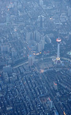
老成都地图 201009 - panoramio.jpg 460 × 660; 255 KB
-
郫都区行政区划.svg 724 × 614; 170 KB


