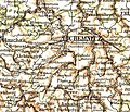
Category:Maps of Chemnitz
Jump to navigation
Jump to search
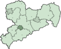
Districts of Saxony:
Deutsch: Karten von Chemnitz.
Hornjoserbsce: Geografiske karty Kamjenicy.
Wikimedia category | |||||
| Upload media | |||||
| Instance of | |||||
|---|---|---|---|---|---|
| Category combines topics | |||||
| Chemnitz | |||||
city in Saxony, Germany  Schloßteich und Innenstadt  Theaterplatz und Opernhaus bei Nacht  Chemnitz as seen from an airplane (June 2012)    Ortseingangsschild an der Niederwiesaer Straße, Chemnitz-Ebersdorf  | |||||
| Pronunciation audio | |||||
| Instance of |
| ||||
| Named after |
| ||||
| Location |
| ||||
| Located in or next to body of water | |||||
| Head of government |
| ||||
| Significant event | |||||
| Population |
| ||||
| Area |
| ||||
| Elevation above sea level |
| ||||
| Different from | |||||
| official website | |||||
 | |||||
Subcategories
This category has the following 3 subcategories, out of 3 total.
Media in category "Maps of Chemnitz"
The following 79 files are in this category, out of 79 total.
-
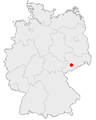
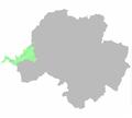
 Lage der kreisfreien Stadt Chemnitz in Deutschland.png 176 × 234; 4 KB
-
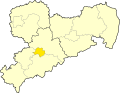
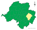
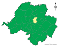
 Sachsen rbchemnitz.png 800 × 640; 13 KB
-
 2021-06-05-Chemnitz-Lageplan-Pflegeheim-Niklasberg-und-ehem-Nikolaikirche.jpg 4,608 × 3,456; 3.53 MB
-
 Abriss Karthalle Chemnitz.gif 900 × 700; 6.4 MB
-
 AHS Chemnitz.jpg 709 × 606; 157 KB
-
 AHS Flöha.jpg 639 × 612; 142 KB
-
 Bernsdorfer Bach.svg 829 × 651; 45 KB
-
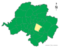
 Chemnitz-Position.png 188 × 235; 5 KB
-
 Saxony Chemnitz 2008.png 800 × 640; 10 KB
-
 Chemnitz Eingemeindungen.jpg 756 × 600; 245 KB
-
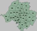
 Chemnitz stadtteilnummern.svg 550 × 460; 86 KB
-
 Chemnitz und Rabensteiner Wald.svg 1,195 × 1,080; 19 KB
-
 Chemnitz-Chemnitzfluss.jpg 630 × 500; 80 KB
-
 Chemnitz-Fritz-Heckert-Gebiet.jpg 761 × 600; 79 KB
-
 Chemnitz-pop per skm.png 550 × 460; 44 KB
-
 Chemnitz-stadtteilnummern.jpg 499 × 411; 50 KB
-
 Chemnitz.svg 1,670 × 906; 8.57 MB
-
 Einwohnerdichte-Chemnitz.svg 1,250 × 1,000; 196 KB
-
 Heckert area.jpg 644 × 800; 58 KB
-
 Hilbersdorf-Karte.jpg 973 × 657; 744 KB
-
 Karl-Marx-Stadt in German Democratic Republic.svg 618 × 789; 3 MB
-
 C in Sachsen.svg 738 × 572; 58 KB
-
 Lage des Regierungsbezirkes Chemnitz in Deutschland.GIF 176 × 234; 3 KB
-
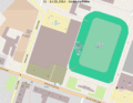
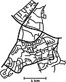
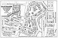
 Lageplan Zentralhaltestelle Chemnitz.svg 2,082 × 1,876; 2.09 MB
-
 Locator map C in Saxony.svg 2,068 × 1,508; 805 KB
-
 Rabensteiner Wald 1936.jpg 2,174 × 1,748; 389 KB
-
 Rabensteiner Wald in Chemnitz.png 1,979 × 1,787; 65 KB
-
 Saxony C.svg 2,268 × 1,814; 788 KB
-
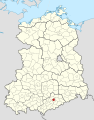
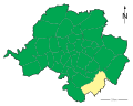
 Saxony Direktionsbezirk Chemnitz.png 800 × 640; 31 KB
-
 Stadt-Siegmar-Schoenau.jpg 775 × 608; 63 KB
-
 Stadt Chemnitz und Rabensteiner Wald.pdf 1,991 × 1,800; 66 KB
-
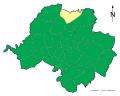
 Stadtteil Chemnitz-Adelsberg.svg 1,250 × 1,000; 153 KB
-
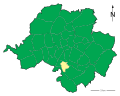
 Stadtteil Chemnitz-Altchemnitz.svg 1,250 × 1,000; 153 KB
-
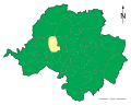
 Stadtteil Chemnitz-Altendorf.svg 1,250 × 1,000; 153 KB
-
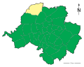
 Stadtteil-Chemnitz-Bernsdorf.svg 1,250 × 1,000; 153 KB
-
 Stadtteil-Chemnitz-Borna-Heinersdorf.svg 1,250 × 1,000; 153 KB
-
 Stadtteil-Chemnitz-Ebersdorf.svg 1,250 × 1,000; 153 KB
-
 Stadtteil-Chemnitz-Einsiedel.svg 1,250 × 1,000; 153 KB
-
 Stadtteil-Chemnitz-Erfenschlag.svg 1,250 × 1,000; 153 KB
-
 Stadtteil-Chemnitz-Euba.svg 1,250 × 1,000; 153 KB
-
 Stadtteil-Chemnitz-Furth.svg 1,250 × 1,000; 153 KB
-
 Stadtteil-Chemnitz-Gablenz.svg 1,250 × 1,000; 153 KB
-
 Stadtteil-Chemnitz-Gloesa-Draisdorf.svg 1,250 × 1,000; 153 KB
-
 Stadtteil-Chemnitz-Gruena.svg 1,250 × 1,000; 153 KB
-
 Stadtteil-Chemnitz-Harthau.svg 1,250 × 1,000; 153 KB
-
 Stadtteil-Chemnitz-Helbersdorf.svg 1,250 × 1,000; 153 KB
-
 Stadtteil-Chemnitz-Hilbersdorf.svg 1,250 × 1,000; 153 KB
-
 Stadtteil-Chemnitz-Hutholz.svg 1,250 × 1,000; 153 KB
-
 Stadtteil-Chemnitz-Kapellenberg.svg 1,250 × 1,000; 153 KB
-
 Stadtteil-Chemnitz-Kappel.svg 1,250 × 1,000; 153 KB
-
 Stadtteil-Chemnitz-Kassberg.svg 1,250 × 1,000; 153 KB
-
 Stadtteil-Chemnitz-Klaffenbach.svg 1,250 × 1,000; 153 KB
-
 Stadtteil-Chemnitz-Kleinolbersdorf-Altenhain.svg 1,250 × 1,000; 153 KB
-
 Stadtteil-Chemnitz-Lutherviertel.svg 1,250 × 1,000; 153 KB
-
 Stadtteil-Chemnitz-Markersdorf.svg 1,250 × 1,000; 153 KB
-
 Stadtteil-Chemnitz-Mittelbach.svg 1,250 × 1,000; 153 KB
-
 Stadtteil-Chemnitz-Morgenleite.svg 1,250 × 1,000; 153 KB
-
 Stadtteil-Chemnitz-Rabenstein.svg 1,250 × 1,000; 153 KB
-
 Stadtteil-Chemnitz-Reichenbrand.svg 1,250 × 1,000; 153 KB
-
 Stadtteil-Chemnitz-Reichenhain.svg 1,250 × 1,000; 153 KB
-
 Stadtteil-Chemnitz-Roehrsdorf.svg 1,250 × 1,000; 153 KB
-
 Stadtteil-Chemnitz-Rottluff.svg 1,250 × 1,000; 153 KB
-
 Stadtteil-Chemnitz-Schlosschemnitz.svg 1,250 × 1,000; 153 KB
-
 Stadtteil-Chemnitz-Schoenau.svg 1,250 × 1,000; 153 KB
-
 Stadtteil-Chemnitz-Siegmar.svg 1,250 × 1,000; 153 KB
-
 Stadtteil-Chemnitz-Sonnenberg.svg 1,250 × 1,000; 153 KB
-
 Stadtteil-Chemnitz-Stelzendorf.svg 1,250 × 1,000; 153 KB
-
 Stadtteil-Chemnitz-Wittgensdorf.svg 1,250 × 1,000; 153 KB
-
 Stadtteil-Chemnitz-Yorckgebiet.svg 1,250 × 1,000; 153 KB
-
 Stadtteil-Chemnitz-Zentrum.svg 1,250 × 1,000; 153 KB
-
 Stadtteil-Karte-Chemnitz.svg 800 × 640; 168 KB
-
 Stiftkirche Ebersdorf Grundriss.png 559 × 815; 609 KB
-
 Stiftkirche Ebersdorf Plan.png 561 × 634; 394 KB
-
 Sächsische-Maschinenfabrik-Chemnitz-Lageplan-1900.jpg 3,599 × 2,367; 1.35 MB
-
 Treffen-Chemnitz.jpg 178 × 298; 21 KB
-
 Wettbewerbsentwurf Stadtplan Chemnitz.jpg 1,600 × 1,154; 1.94 MB
-
 Zeisigwald.jpg 800 × 631; 121 KB
-
 Zeisigwaldkarte.png 1,736 × 1,571; 2.1 MB
-
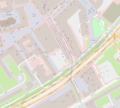 Zentralhaltestelle-Chemnitz-2019-OSM.png 2,082 × 1,876; 1.49 MB


