Category:Maps of Chatham, Kent
Jump to navigation
Jump to search
Media in category "Maps of Chatham, Kent"
The following 11 files are in this category, out of 11 total.
-
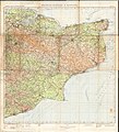
 167 of '(Our own country. Descriptive, historical, pictorial.)' (11247453865).jpg 1,896 × 1,561; 893 KB
-

-
 167 of '(Our own country. Descriptive, historical, pictorial.)' (11177303284).jpg 2,033 × 1,550; 933 KB
-
 Map of Chatham, Kent, 1890.png 785 × 729; 844 KB
-
 Ordnance Survey Half-inch Sheet 40 Chatham Margate & Hastings, Published 1927.jpg 10,227 × 11,226; 13.78 MB
-
 Ordnance Survey One-Inch Sheet 172 Chatham & Maidstone, Published 1940.jpg 10,979 × 12,747; 17 MB
-
 Ordnance Survey One-Inch Sheet 172 Chatham & Maidstone, Published 1957.jpg 11,484 × 14,201; 19.32 MB
-
 Ordnance Survey One-inch Sheet 172 Chatham & Maidstone, Published 1970.jpg 11,122 × 13,163; 61.75 MB
-
 The River Wall Information Board - geograph.org.uk - 1613034.jpg 427 × 640; 42 KB
-
 Chatham Waterfront Map - geograph.org.uk - 2646966.jpg 3,216 × 4,288; 4.34 MB
-
 Geology Chatham Sketch Map Page018.jpg 3,317 × 1,918; 1.49 MB
%27_(11247453865).jpg)
%27_(11253229584).jpg)
%27_(11177303284).jpg)


