Category:Maps of Chalatenango Department
Jump to navigation
Jump to search
Subcategories
This category has only the following subcategory.
Media in category "Maps of Chalatenango Department"
The following 5 files are in this category, out of 5 total.
-
 Chalatenango.svg 512 × 395; 31 KB
-
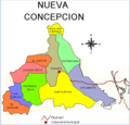 División territorial de Nueva Concepción.png 753 × 720; 168 KB
-
 El Salvador Chalatenango location map.svg 983 × 624; 104 KB
-
 El Salvador-Chalatenango.png 149 × 81; 3 KB
-
 Localización del departamento de Chalatenango.svg 512 × 299; 1.67 MB


