Category:Maps of Chūgoku region
Jump to navigation
Jump to search
Wikimedia category | |||||
| Upload media | |||||
| Instance of | |||||
|---|---|---|---|---|---|
| Category combines topics | |||||
| Chūgoku region | |||||
region of Japan   | |||||
| Instance of |
| ||||
| Part of |
| ||||
| Location | Japan | ||||
| Located in or next to body of water | |||||
| Has part(s) |
| ||||
| Highest point | |||||
| Population |
| ||||
| Area |
| ||||
 | |||||
Media in category "Maps of Chūgoku region"
The following 24 files are in this category, out of 24 total.
-
 Chugoku Region Administration Map TC.png 600 × 600; 43 KB
-
 Chugoku Region in Japan (extended).svg 580 × 578; 1.58 MB
-
 Chugoku Region in Japan (narrow).svg 271 × 363; 1.71 MB
-
 Chugoku Region in Japan.svg 413 × 373; 1.58 MB
-
 Chugoku.png 3,418 × 3,008; 1.71 MB
-
 Chugoku.svg 744 × 1,052; 889 KB
-
 Chuugoku hrdist map 2003.PNG 667 × 494; 24 KB
-
 Eight regions of japan6 chugoku.png 500 × 400; 16 KB
-
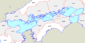
 Geofeatures map of Chugoku Japan ja.svg 1,500 × 900; 3.76 MB
-
 Japan Chugoku Map Chikei.gif 610 × 400; 71 KB
-
 Japan Chugoku Region large.png 1,397 × 1,593; 103 KB
-
 Japan Chugoku Region.png 369 × 261; 16 KB
-
 Japan Chūshikoku Region large.png 1,397 × 1,593; 89 KB
-
 Japan Setouchi Region large.png 1,397 × 1,593; 89 KB
-
 JpLargeMap Chugoku.png 1,260 × 919; 40 KB
-
 SanIn-region Small.png 199 × 228; 2 KB
-
 SanYo-region Small.png 199 × 228; 2 KB
-
 Seto Inland Sea01.png 875 × 444; 15 KB
-
 Seto Inland Sea02.png 875 × 444; 15 KB
-
 Shimane pref.png 309 × 513; 13 KB
-
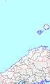
 Tottori and Shimane in Japan (claimed).svg 413 × 373; 956 KB
-
 「竹の谷蔓」及び4蔓の発祥地.jpg 1,354 × 762; 124 KB
-
 中国大返还示意.jpg 600 × 466; 151 KB
-
 中国山地.jpg 1,336 × 752; 151 KB

.svg)
.svg)


.svg)