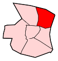
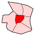
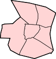
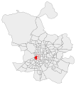
Category:Maps of Centro District, Madrid
Jump to navigation
Jump to search
Districts of Madrid: Arganzuela · Barajas · Carabanchel · Centro · Chamartín · Chamberí · Ciudad Lineal · Fuencarral-El Pardo · Hortaleza · Latina · Moncloa-Aravaca · Moratalaz · Puente de Vallecas · Retiro · Salamanca · San Blas-Canillejas · Tetuán · Usera · Vicálvaro · Villa de Vallecas · Villaverde
Media in category "Maps of Centro District, Madrid"
The following 27 files are in this category, out of 27 total.
-
Barrio de Cortes (13), Madrid.svg 841 × 878; 8 KB
-
Barrio de Embajadores (12), Madrid.svg 841 × 878; 8 KB
-
Barrio de Justicia (14), Madrid.svg 841 × 878; 7 KB
-
Barrio de Palacio (11), Madrid.svg 841 × 878; 8 KB
-
Barrio de Sol (16), Madrid.svg 841 × 878; 8 KB
-
Barrio de Universidad (15), Madrid.svg 841 × 878; 7 KB
-
Barrios del Distrito Centro (Madrid).svg 841 × 878; 61 KB
-
Centro de Madrid.png 433 × 513; 16 KB
-
Centro District loc-map.svg 527 × 527; 28 KB
-
Cortes. 13. Barrios de Madrid.svg 462 × 517; 114 KB
-
Distrito Centro (Madrid).svg 761 × 798; 7 KB
-
Distrito Centro - Embajadores.JPG 542 × 495; 17 KB
-
Distrito Centro - JusticiaJPG.JPG 542 × 495; 17 KB
-
Embajadores. 12. Barrios de Madrid.svg 462 × 517; 114 KB
-
Justicia. 14. Barrios de Madrid.svg 462 × 517; 114 KB
-
Maps - ES - Madrid - Centro - Cortes.PNG 542 × 495; 12 KB
-
Maps - ES - Madrid - Centro - Embajadores.PNG 542 × 495; 12 KB
-
Maps - ES - Madrid - Centro - Justicia.PNG 542 × 495; 12 KB
-
Maps - ES - Madrid - Centro - Palacio.PNG 542 × 495; 12 KB
-
Maps - ES - Madrid - Centro - Sol.PNG 542 × 495; 12 KB
-
Maps - ES - Madrid - Centro - Universidad.PNG 542 × 495; 12 KB
-
Maps - ES - Madrid - Centro detail.PNG 542 × 495; 12 KB
-
Maps - ES - Madrid - Centro.PNG 455 × 540; 14 KB
-
Palacio. 11. Barrios de Madrid.svg 462 × 517; 114 KB
-
Sol. 16. Barrios de Madrid.svg 462 × 517; 114 KB
-
Universidad. 15. Barrios de Madrid.svg 462 × 517; 108 KB


