Category:Maps of Central Bedfordshire District
Jump to navigation
Jump to search
English: Maps of the Central Bedfordshire district, in the ceremonial county of Bedfordshire, England.
Subcategories
This category has only the following subcategory.
Media in category "Maps of Central Bedfordshire District"
The following 6 files are in this category, out of 6 total.
-
 Central Bedfordshire in England (zoom).svg 816 × 991; 1.31 MB
-
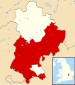
 Central Bedfordshire in England.svg 816 × 991; 1.32 MB
-
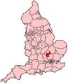
 Central Bedfordshire UK locator map.svg 1,120 × 1,266; 675 KB
-
 Central Bedfordshire UK ward map 2010 (blank).svg 1,139 × 1,266; 698 KB
-
 Central Bedfordshire UK ward map 2011 (blank).svg 1,139 × 1,266; 706 KB
-
 EnglandCentralBedfordshire.png 200 × 247; 25 KB
.svg)


.svg)
.svg)