Category:Maps of Cazalis (Landes)
Jump to navigation
Jump to search
Wikimedia category | |||||
| Upload media | |||||
| Instance of | |||||
|---|---|---|---|---|---|
| Category combines topics | |||||
| Cazalis | |||||
commune in Landes, France .jpg) _OSM_03.png) | |||||
| Instance of | |||||
| Location |
| ||||
| Population |
| ||||
| Area |
| ||||
| Different from | |||||
| official website | |||||
 | |||||
Media in category "Maps of Cazalis (Landes)"
The following 8 files are in this category, out of 8 total.
-
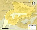 40079-Cazalis-argile.jpg 3,057 × 2,480; 445 KB
-
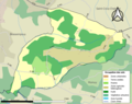 40079-Cazalis-Sols.png 3,270 × 2,598; 1.18 MB
-
 40079-Cazalis-ZNIEFF1.png 4,692 × 3,307; 2.82 MB
-
 40079-Cazalis-ZNIEFF2.png 5,866 × 4,133; 3.45 MB
-
 Cazalis (Landes) OSM 01.png 549 × 456; 126 KB
-
 Cazalis (Landes) OSM 02.png 549 × 456; 295 KB
-
 Cazalis (Landes) OSM 03.png 549 × 456; 177 KB
-
 Map commune FR insee code 40079.png 756 × 605; 25 KB


_OSM_01.png)
_OSM_02.png)
