Category:Maps of Carabobo (state)
Jump to navigation
Jump to search
Federal territory: Capital District · Federal Dependencies · Territorial claim: Guayana Esequiba
| NO WIKIDATA ID FOUND! Search for Maps of Carabobo (state) on Wikidata | |
| Upload media |

Subcategories
This category has the following 8 subcategories, out of 8 total.
!
*
M
O
Media in category "Maps of Carabobo (state)"
The following 7 files are in this category, out of 7 total.
-
 Estadodocarabobo.jpg 855 × 628; 167 KB
-
 Flag Map of Carabobo.png 1,592 × 1,374; 127 KB
-
 Guigueencarabobo.jpg 800 × 588; 46 KB
-
 Köppen Cordillera Costa Central.png 6,574 × 4,176; 826 KB
-
 Mapa de isla larga Parque Nacional San Esteban.svg 526 × 372; 86 KB
-
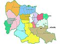
 Parroquias Carabobo.png 339 × 290; 10 KB
-
 ZonaClimatica CordilleraCostaCentral.png 6,551 × 4,773; 1.48 MB


