Category:Maps of Cape Town suburbs
Jump to navigation
Jump to search
Maps of suburbs of Cape Town. These are mostly OpenStreetMap maps.
Media in category "Maps of Cape Town suburbs"
The following 33 files are in this category, out of 33 total.
-
 Camps Bay map.jpg 636 × 566; 259 KB
-
 Camps Bay map.PNG 628 × 557; 314 KB
-
 Cape Towns original vegetation types.jpg 4,967 × 6,956; 10.34 MB
-
 Cape Towns surviving vegetation types.jpg 4,967 × 6,967; 10.66 MB
-
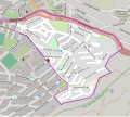
 Claremont OSM map small.svg 446 × 299; 1.05 MB
-
 Claremont OSM map.svg 1,118 × 749; 5.19 MB
-
 De Waterkant map.svg 976 × 840; 1.64 MB
-
 Devils Peak Estate OSM map.svg 670 × 599; 1.84 MB
-
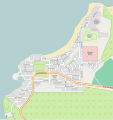
 Fish Hoek map.jpg 441 × 368; 145 KB
-
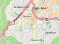 Gardens OSM map small.svg 338 × 251; 952 KB
-
 Gardens OSM map.svg 1,126 × 838; 6.42 MB
-
 Green Point map.svg 976 × 840; 3.46 MB
-
 Gugulethu Map.jpg 762 × 515; 346 KB
-
 Kommetjie OSM map.svg 1,041 × 1,101; 1.66 MB
-
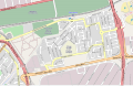
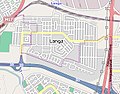 Langa map.jpg 327 × 257; 117 KB
-
 Mowbray OSM map small.svg 430 × 259; 1.13 MB
-
 Mowbray OSM map.svg 1,291 × 779; 4.14 MB
-
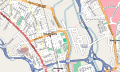
 Newlands OSM map.svg 1,361 × 859; 4.86 MB
-
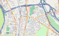
 Observatory OSM map.svg 876 × 524; 2.68 MB
-
 Oranjezicht OSM map.svg 480 × 639; 2.27 MB
-
 OSM Pinelands map small.svg 408 × 395; 1.3 MB
-
 OSM Pinelands map.svg 1,358 × 1,318; 6.65 MB
-
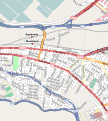
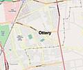 Ottery map.jpg 582 × 496; 269 KB
-
 Philippi, Cape Town map.svg 2,798 × 2,123; 12.29 MB
-
 Rondebosch OSM map small.svg 536 × 451; 1.9 MB
-
 Rondebosch OSM map.svg 1,073 × 904; 5.62 MB
-
 Rosebank OSM map small.svg 364 × 259; 768 KB
-
 Rosebank OSM map.svg 1,364 × 1,060; 4.57 MB
-
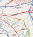 Salt River OSM map.svg 720 × 790; 3.08 MB
-
 Thornton OSM map small.svg 496 × 319; 628 KB
-
 Thornton OSM map.svg 994 × 639; 2.14 MB
-
 Vredehoek OSM map.svg 496 × 619; 2.37 MB
-
 Woodstock OSM map.svg 725 × 808; 3.17 MB


