Category:Maps of Cameron County, Texas
Jump to navigation
Jump to search
Counties of Texas: Anderson · Andrews · Angelina · Aransas · Archer · Armstrong · Atascosa · Austin · Bailey · Bandera · Bastrop · Baylor · Bee · Bell · Bexar · Blanco · Borden · Bosque · Bowie · Brazoria · Brazos · Brewster · Briscoe · Brooks · Brown · Buchel · Burleson · Burnet · Caldwell · Calhoun · Callahan · Cameron · Camp · Carson · Cass · Castro · Chambers · Cherokee · Childress · Clay · Cochran · Coke · Coleman · Collin · Collingsworth · Colorado · Comal · Comanche · Concho · Cooke · Coryell · Cottle · Crane · Crockett · Crosby · Culberson · Dallam · Dallas · Dawson · Deaf Smith · Delta · Denton · DeWitt · Dickens · Dimmit · Donley · Duval · Eastland · Ector · Edwards · El Paso · Ellis · Erath · Falls · Fannin · Fayette · Fisher · Floyd · Foard · Foley · Fort Bend
· Franklin · Freestone · Frio · Gaines · Galveston · Garza · Gillespie · Glasscock · Goliad · Gonzales · Gray · Grayson · Gregg · Grimes · Guadalupe · Hale · Hall · Hamilton · Hansford · Hardeman · Hardin · Harris · Harrison · Hartley · Haskell · Hays · Hemphill · Henderson · Hidalgo · Hill · Hockley · Hood · Hopkins · Houston · Howard · Hudspeth · Hunt · Hutchinson · Irion · Jack · Jackson · Jasper · Jeff Davis · Jefferson · Jim Hogg · Jim Wells · Johnson · Jones · Karnes · Kaufman · Kendall · Kenedy · Kent · Kerr · Kimble · King · Kinney · Kleberg · Knox · La Salle · Lamar · Lamb · Lampasas · Lavaca · Lee · Leon · Liberty · Limestone · Lipscomb · Live Oak · Llano · Loving · Lubbock · Lynn · Madison · Marion · Martin · Mason · Matagorda · Maverick · McCulloch · McLennan · McMullen · Medina · Menard · Midland · Milam · Mills · Mitchell · Montague · Montgomery · Moore · Morris · Motley · Nacogdoches · Navarro · Newton · Nolan · Nueces · Ochiltree · Oldham · Orange · Palo Pinto · Panola · Parker · Parmer · Pecos · Polk · Potter · Presidio · Rains · Randall · Reagan · Real · Red River · Reeves · Refugio · Roberts · Robertson · Rockwall · Runnels · Rusk · Sabine · San Augustine · San Jacinto · San Patricio · San Saba · Schleicher · Scurry · Shackelford · Shelby · Sherman · Smith · Somervell · Starr · Stephens · Sterling · Stonewall · Sutton · Swisher · Tarrant · Taylor · Terrell · Terry · Throckmorton · Titus · Tom Green · Travis · Trinity · Tyler · Upshur · Upton · Uvalde · Val Verde · Van Zandt · Victoria · Walker · Waller · Ward · Washington · Webb · Wharton · Wheeler · Wichita · Wilbarger · Willacy · Williamson · Wilson · Winkler · Wise · Wood · Worth · Yoakum · Young · Zapata · Zavala
Wikimedia category | |||||
| Upload media | |||||
| Instance of | |||||
|---|---|---|---|---|---|
| Category combines topics | |||||
| Cameron County | |||||
county in Texas, United States   | |||||
| Instance of | |||||
| Named after |
| ||||
| Location | Texas | ||||
| Capital | |||||
| Inception |
| ||||
| Population |
| ||||
| Area |
| ||||
| Different from | |||||
| official website | |||||
 | |||||
Media in category "Maps of Cameron County, Texas"
The following 55 files are in this category, out of 55 total.
-
 BHR CSA.png 491 × 455; 9 KB
-
 Boca Chica Village, Texas.svg 870 × 774; 3.09 MB
-
 Brazos island 0001.png 544 × 538; 8 KB
-
 Cameron County ArroyoColoradoEstates.svg 997 × 730; 562 KB
-
 Cameron County ArroyoGardens-LaTinaRanch.svg 997 × 730; 562 KB
-
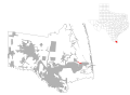
 Cameron County Bayview highlighted.svg 997 × 730; 851 KB
-
 Cameron County Bixby.svg 997 × 730; 562 KB
-
 Cameron County Bluetown-IglesiaAntigua.svg 997 × 730; 562 KB
-
 Cameron County Brownsville Highlighted.svg 792 × 612; 534 KB
-
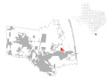
 Cameron County CameronPark.svg 997 × 730; 562 KB
-
 Cameron County ChulaVista-Orason.svg 997 × 730; 562 KB
-
 Cameron County Combes.svg 997 × 730; 562 KB
-
 Cameron County DelMarHeights.svg 997 × 730; 562 KB
-
 Cameron County ElCaminoAngosto.svg 997 × 730; 562 KB
-
 Cameron County Encantada-RanchoElCalaboz.svg 997 × 730; 562 KB
-
 Cameron County GrandAcres.svg 997 × 730; 563 KB
-
 Cameron County GreenValleyFarms.svg 997 × 730; 562 KB
-
 Cameron County Harlingen.svg 997 × 730; 563 KB
-
 Cameron County IndianLake.svg 997 × 730; 562 KB
-
 Cameron County LaFeria.svg 997 × 730; 562 KB
-
 Cameron County LaFeriaNorth.svg 997 × 730; 562 KB
-
 Cameron County Lago.svg 997 × 730; 562 KB
-
 Cameron County LagunaHeights.svg 997 × 730; 562 KB
-
 Cameron County LagunaVista.svg 997 × 730; 562 KB
-
 Cameron County LaPaloma.svg 997 × 730; 562 KB
-
 Cameron County Lasana.svg 997 × 730; 562 KB
-
 Cameron County LasPalmas-Juarez.svg 997 × 730; 562 KB
-
 Cameron County Laureles.svg 997 × 730; 562 KB
-
 Cameron County LosFresnos.svg 997 × 730; 562 KB
-
 Cameron County LosIndios.svg 997 × 730; 562 KB
-
 Cameron County Lozano.svg 997 × 730; 562 KB
-
 Cameron County Olmito.svg 997 × 730; 562 KB
-
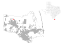
 Cameron County PalmValley.svg 997 × 730; 562 KB
-
 Cameron County PortIsabel.svg 997 × 730; 562 KB
-
 Cameron County Primera.svg 997 × 730; 562 KB
-
 Cameron County RanchoViejo.svg 997 × 730; 562 KB
-
 Cameron County Rangerville.svg 997 × 730; 562 KB
-
 Cameron County Ratamosa.svg 997 × 730; 562 KB
-
 Cameron County ReidHopeKing.svg 997 × 730; 562 KB
-
 Cameron County RioHondo.svg 997 × 730; 562 KB
-
 Cameron County SanBenito.svg 997 × 730; 562 KB
-
 Cameron County SanPedro.svg 997 × 730; 562 KB
-
 Cameron County SantaMaria.svg 997 × 730; 562 KB
-
 Cameron County SantaRosa.svg 997 × 730; 562 KB
-
 Cameron County Solis.svg 997 × 730; 562 KB
-
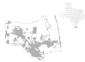
 Cameron County SouthPadreIsland.svg 997 × 730; 562 KB
-
 Cameron County SouthPoint.svg 997 × 730; 562 KB
-
 Cameron County Texas.png 300 × 284; 13 KB
-
 Cameron County TierraBonita.svg 997 × 730; 562 KB
-
 Cameron County VillaDelsol.svg 997 × 730; 562 KB
-
 Cameron County VillaPancho.svg 997 × 730; 562 KB
-
 Cameron County Yznaga.svg 997 × 730; 562 KB
-
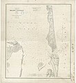 Chart, Point Isabel-Brazos Santiago - NARA - 87201507.jpg 5,792 × 6,238; 2.22 MB
-
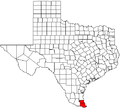
 Map of Texas highlighting Cameron County.svg 1,386 × 1,317; 222 KB
-
 Padre island 0001.png 514 × 767; 30 KB


