Category:Maps of Butetown
Jump to navigation
Jump to search
Media in category "Maps of Butetown"
The following 6 files are in this category, out of 6 total.
-
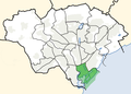 Cardiff ward location - Butetown.png 800 × 571; 160 KB
-
 Insurance Plan of Cardiff; sheet 6-1 (BL 148014).tiff 3,158 × 3,773; 34.09 MB
-
 Insurance Plan of Cardiff; sheet 7-1 (BL 148016).tiff 1,579 × 3,755; 16.96 MB
-
 Insurance Plan of Cardiff; sheet 7-2 (BL 148018).tiff 1,519 × 3,755; 16.32 MB
-
 Map of Cardiff and its Environs OS Map name 047-03, Ordnance Survey, 1875-1882.png 11,317 × 7,523; 24.82 MB
-
 Mount Stuart Square 1920.jpg 497 × 424; 88 KB


