Category:Maps of Budos (Gironde)
Jump to navigation
Jump to search
Subcategories
This category has only the following subcategory.
O
- Old maps of Budos (Gironde) (2 F)
Media in category "Maps of Budos (Gironde)"
The following 7 files are in this category, out of 7 total.
-
 33076-Budos-relief.png 3,057 × 2,480; 2.46 MB
-
 33076-Budos-Routes-Hydro.png 3,507 × 2,480; 1.55 MB
-
 33076-Budos-Sols.png 3,270 × 2,598; 1.77 MB
-
 33076-Budos-ZNIEFF2.png 5,866 × 4,133; 5.19 MB
-
 Budos (Gironde) dans son Arrondissement.png 2,000 × 2,467; 646 KB
-
 Budos Limite communale.jpg 954 × 574; 148 KB
-
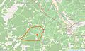
 Map commune FR insee code 33076.png 756 × 605; 40 KB


_dans_son_Arrondissement.png)

